Return to flip book view
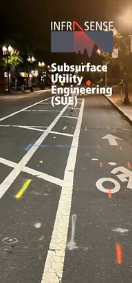
Message Subsurface Utility Engineering (SUE)21-G Olympia Ave, Suite 45Woburn, Massachusetts 01801infrasense.comGet in touch today to learn more!What We DoPerform subsurface utility engineering (SUE) surveys using complimentary locating techniques including ground penetrative radar (GPR), electromagnetic indication (EMI), and direct physical measurements. Some of the key elements of success to our SUE approach include:• In accordance with CI/ASCE 38-02, “Standard Guideline for the Collection and Depiction of Existing Subsurface Utility Data”• Review and aggregate as-built drawings and design records• Comprehensive GPR collection; multiple antenna frequencies, vehicle array and cart-based systems• Active and Passive EMI tracing by highly experienced professionals• Supplemental geophysical methods used where needed (EM-61, magnetic locators)• Manhole exploration• GPS logging of utility locations (sub-2cm accuracy)• Video survey of project section
Subsurface Utility Engineering (SUE)21-G Olympia Ave, Suite 45Woburn, Massachusetts 01801infrasense.comGet in touch today to learn more!What We DoPerform subsurface utility engineering (SUE) surveys using complimentary locating techniques including ground penetrative radar (GPR), electromagnetic indication (EMI), and direct physical measurements. Some of the key elements of success to our SUE approach include:• In accordance with CI/ASCE 38-02, “Standard Guideline for the Collection and Depiction of Existing Subsurface Utility Data”• Review and aggregate as-built drawings and design records• Comprehensive GPR collection; multiple antenna frequencies, vehicle array and cart-based systems• Active and Passive EMI tracing by highly experienced professionals• Supplemental geophysical methods used where needed (EM-61, magnetic locators)• Manhole exploration• GPS logging of utility locations (sub-2cm accuracy)• Video survey of project section
Subsurface Utility Engineering (SUE)21-G Olympia Ave, Suite 45Woburn, Massachusetts 01801infrasense.comGet in touch today to learn more!What We DoPerform subsurface utility engineering (SUE) surveys using complimentary locating techniques including ground penetrative radar (GPR), electromagnetic indication (EMI), and direct physical measurements. Some of the key elements of success to our SUE approach include:• In accordance with CI/ASCE 38-02, “Standard Guideline for the Collection and Depiction of Existing Subsurface Utility Data”• Review and aggregate as-built drawings and design records• Comprehensive GPR collection; multiple antenna frequencies, vehicle array and cart-based systems• Active and Passive EMI tracing by highly experienced professionals• Supplemental geophysical methods used where needed (EM-61, magnetic locators)• Manhole exploration• GPS logging of utility locations (sub-2cm accuracy)• Video survey of project section
Multi-Channel GPR Array System Using the integrated 18 channel GPR system we can image the subsurface in 3-dimensions with incredibly high density while maintaining regular driving speed. A breakout cart allows the center channels to be collected along sidewalks and other limited access areas for full coverage of a site. The system is fully integrated with GPS, and adaptable to any vehicle, including all-terrain vehicles.dataWhat You GetThe SUE data is analyzed using industry standard software, and resulting utility locations, depths, and service types are compiled in AutoCAD to produce the following deliverables:• CADD compatible plan-view maps showing locations of utilities, utility features, and obstructions (.dwg, .dxf)• Metadata for each utility line including service type, tracking method, and depth below surface.• Subsurface Utility Engineering (SUE) Report• Logs for SUE Level-A Daylighting, operations • Records of the manhole/vault position and size, including measurements and photosresultsSUE results are used to conrm and adjust the position of both known and unknown buried utilities. Subsurface Utility Engineering (SUE)
Multi-Channel GPR Array System Using the integrated 18 channel GPR system we can image the subsurface in 3-dimensions with incredibly high density while maintaining regular driving speed. A breakout cart allows the center channels to be collected along sidewalks and other limited access areas for full coverage of a site. The system is fully integrated with GPS, and adaptable to any vehicle, including all-terrain vehicles.dataWhat You GetThe SUE data is analyzed using industry standard software, and resulting utility locations, depths, and service types are compiled in AutoCAD to produce the following deliverables:• CADD compatible plan-view maps showing locations of utilities, utility features, and obstructions (.dwg, .dxf)• Metadata for each utility line including service type, tracking method, and depth below surface.• Subsurface Utility Engineering (SUE) Report• Logs for SUE Level-A Daylighting, operations • Records of the manhole/vault position and size, including measurements and photosresultsSUE results are used to conrm and adjust the position of both known and unknown buried utilities. Subsurface Utility Engineering (SUE)
Multi-Channel GPR Array System Using the integrated 18 channel GPR system we can image the subsurface in 3-dimensions with incredibly high density while maintaining regular driving speed. A breakout cart allows the center channels to be collected along sidewalks and other limited access areas for full coverage of a site. The system is fully integrated with GPS, and adaptable to any vehicle, including all-terrain vehicles.dataWhat You GetThe SUE data is analyzed using industry standard software, and resulting utility locations, depths, and service types are compiled in AutoCAD to produce the following deliverables:• CADD compatible plan-view maps showing locations of utilities, utility features, and obstructions (.dwg, .dxf)• Metadata for each utility line including service type, tracking method, and depth below surface.• Subsurface Utility Engineering (SUE) Report• Logs for SUE Level-A Daylighting, operations • Records of the manhole/vault position and size, including measurements and photosresultsSUE results are used to conrm and adjust the position of both known and unknown buried utilities. Subsurface Utility Engineering (SUE)
Multi-Channel GPR Array System Using the integrated 18 channel GPR system we can image the subsurface in 3-dimensions with incredibly high density while maintaining regular driving speed. A breakout cart allows the center channels to be collected along sidewalks and other limited access areas for full coverage of a site. The system is fully integrated with GPS, and adaptable to any vehicle, including all-terrain vehicles.dataWhat You GetThe SUE data is analyzed using industry standard software, and resulting utility locations, depths, and service types are compiled in AutoCAD to produce the following deliverables:• CADD compatible plan-view maps showing locations of utilities, utility features, and obstructions (.dwg, .dxf)• Metadata for each utility line including service type, tracking method, and depth below surface.• Subsurface Utility Engineering (SUE) Report• Logs for SUE Level-A Daylighting, operations • Records of the manhole/vault position and size, including measurements and photosresultsSUE results are used to conrm and adjust the position of both known and unknown buried utilities. Subsurface Utility Engineering (SUE)
Subsurface Utility Engineering (SUE)21-G Olympia Ave, Suite 45Woburn, Massachusetts 01801infrasense.comGet in touch today to learn more!What We DoPerform subsurface utility engineering (SUE) surveys using complimentary locating techniques including ground penetrative radar (GPR), electromagnetic indication (EMI), and direct physical measurements. Some of the key elements of success to our SUE approach include:• In accordance with CI/ASCE 38-02, “Standard Guideline for the Collection and Depiction of Existing Subsurface Utility Data”• Review and aggregate as-built drawings and design records• Comprehensive GPR collection; multiple antenna frequencies, vehicle array and cart-based systems• Active and Passive EMI tracing by highly experienced professionals• Supplemental geophysical methods used where needed (EM-61, magnetic locators)• Manhole exploration• GPS logging of utility locations (sub-2cm accuracy)• Video survey of project section