Return to flip book view
!A City of London WalkMichael Strachan
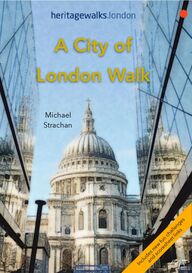
Copyright © heritagewalks.london 2019 75 West Street, Harrow on the Hill, London HA1 3EL info@walkingthepast.co.uk First published in the UK in 2012 Text and images copyright © Michael Strachan Michael Strachan has asserted his rights to be identified as the author of this work in accordance with the Copyright, Designs and Patents Act, 1988. All rights reserved. No part of this publication may be reproduced, stored in a retrieval system, or transmitted, in any form or by any means, electronic or mechanical, by photocopying, recording or otherwise, without prior permission in writing from the publisher. (The cover illustration shows St. Paul’s Cathedral).
!A City of London walkMichael Strachan
INTRODUCTION Walk from the Thames through the area around the Middle Temple, one of the four Inns of Court, then join the hustle and bustle of Fleet Street, long associated with printing, journalism and the Press. Stop at St. Bride’s Church, one of Wren’s finest buildings, before walking up Ludgate Hill through the winding streets to St. Paul’s Cathedral. Sometimes known as the ‘Square Mile’, the City is where England’s capital was founded and its importance in the history and development of trade and commerce is im-mense. The Romans first established a trading port by the River Thames around AD 47 and by the end of the 1st cen-tury CE Londinium was the most prosperous settlement in Roman Britain with a population of more than 50,000. The original boundaries are similar to those of today, still reaching no farther west than the banks of the River Fleet. The Thames was much wider then and a bridge was built near the modern London Bridge. The Roman legacy can still be seen throughout the City. William the Conqueror granted a charter to its citizens in 1075 but built the Tower of London to keep them sub-dued. The City continued to grow and was the location of many guilds and business enterprises. However, it suf-fered setbacks including the Plague of 1665-1666 when 1Thames Embankment 19th centuryThe Royal Courts of JusticeSt Paul’s Cathedral
20% of the population died, followed by the famous Great Fire of 1666. After the Fire, plans were drawn up to rebuild the City with open streets and squares, but the medieval pattern of tiny lanes re-emerged – many of them still in existence today. In the 18th century the City of London enjoyed rapid expansion and the urban area grew beyond the original borders towards the nearby City of Westminster. Much of the City was destroyed by bombing in the Blitz and, walking around, you will see two dates – 1666 and 1940/41 on plaques and memorial stones. Over the past two hundred years ‘The City’ has become a successful fi-nancial centre with banks, stock brokers and insurance companies playing a great part in its growth. To hear this Introduction please click this icon To find out more about ‘What3Words’ please click this information icon 2If you would like to donate an amount which will help us cover our costs and continue to work on new publications please scan or tap the QR link below:
Planning Your Walk 1. If possible, walk with a friend. 2. Tell s omeon e wh ere y ou are go in g. 3. Take c are w hen w al ki ng at n ight. 4. Wear sensible clothes and footwear. 5. Always take a bottle of water to avoid de-hydration. 6. Don't try to do too much in one visit. 7. Check the opening times of all Museums and Galleries online. 8. Take y our c am er a or ca mera ph one w it h batte ri es fu ll y charged. 9. If you are printing out this do staple these!pages!together!. 10. Don’t forget to download your free Quiz and Plaque scoresheets by using the URL links on the next page… Start at Temple Underground station (Circle & District lines) End at St Paul’s Underground station (Central line) Use the Transport for London (TFL) planner to plan your journey. 35.6 km 3.5 miles 2-3 hrs
To make your walk more interesting… …we have created an on-line, interactive map which you can find by clicking the link below, or by scanning the green QR code opposite. This will only work if you are reading this guide on a smart device like an iPad: Plot-a-Route map We have also added some fun challenges - the first is a picture quiz. So you need to look out for interesting ob-jects such as ‘street furniture’, statues and architectural features shown in the I-Spy Challenge scoresheet. Click the link below, or scan the pink QR code opposite, to access a download for this scoresheet. It can then be printed or saved: I-Spy Challenge The second challenge is to ‘bag’ all the plaques along this walk. These are listed on a ‘Pastwalkers’ scoresheet along with their ‘what3words’ loca-tions. (Click the information icon op-posite for more about how ‘What3Words’ works). The plaque scores are based on age and quality rather than the importance of the person or event commemorated. Download by clicking on the link below, or by scanning the blue QR code opposite: Plaque Challenge 4Tick them off when you find them
From The Temple to Saint Paul’s Cathedral From Temple Underground station turn left and walk up the stairs to Temple Place. Turn right, cross the road and continue walking… The area and street name ‘Temple’ is taken from the halls and church of the Knights Templar built here in the 12th century. The Knights Templar, or simply the Templars, were a Catholic military order recognised in 1139 by the papal bull ‘Omne da-tum optimum’. In recent years they have ap-peared in film and television, sometimes as heroes, but also as villains. Number 2 Temple Place was until recently known as Astor House. It was built in 1895 for Amer-ican William Waldorf Astor (1848–1919), lat-er First Viscount Astor of Britain. The proper-ty is of a Tudor-palace style, with overhang-ing first-floor window bays, leaded windows, broad chimney stack and crenellations. The nautical-themed weather vane and ironworks commemorate Columbus and other explor-ers who discovered America. The building is now used by the Bulldog Trust, an educa-tional charity. Turn left into Milford Lane, and, at the end, walk up the stairs to Essex Street… 5William Waldorf Astor
This narrow road and Devereux Court lead-ing off it are named after Robert Devereux, the Earl of Essex (1565 to 1601), who was a favourite courtier of Elizabeth I. He once had a house here but, following his execution, this was removed to make way for Essex Street. The gateway at the top of the stairs is the restored ‘Water Gate’ of the house – the River Thames reached this height before the Thames Embankment was built in the 1860s. King Edward II abolished the Knights Templar in 1307 and gave the land to the Knights Hospitaller. They rented the buildings to colleges of lawyers. Today, many of the buildings in Essex Street are bar-rister’s (advocate’s) chambers. Numbers 11 and 14 Essex Street are classic Georgian buildings, with flat fronts, sash windows that get smaller with each floor, and fine doorways and ironwork. Others are modern offices built after the Second World War, when the street suffered from bomb damage. The first of the plaques on this walk is lo-cated on the right hand side of the street at number 31 where it commemorates the founding of the Im-perial Society of Knights Bachelor on 27th April 1908. Continue to Devereux Court and the Edgar Wal-lace pub… 6Robert Devereux
Via Devereux Court on your right, you can take a detour into Fountain Court and the Middle Tem-ple gardens… This beautiful area of buildings and open spaces dates back to medieval and Tudor times. Many pas-sageways and courtyards are open only on week days during office hours. The area is certainly worth a visit.! If you venture into the precinct, retrace your steps to Essex Street and turn right… The Edgar Wallace pub lies close to the site of the Essex Head pub, where an 18th-century club used to meet. Members included the authors Dr Samuel Johnson and James Boswell, and the artist Sir Joshua Reynolds. On your left as you approach the Strand is Essex Hall - a chapel marked by two plaques. The first Unitarian con-gregation in Great Britain met here in 1774 and the first minister was! Theo-philus Lindsey, who had recently l eft the! Church of England.! Support was immediately given him by!Joseph Priestley who, among other 7Essex Hall in 1874
things, discovered oxygen.! Two hundred people gathered to hear Lindsey preach, including!Benjamin Franklin, then an! agent! for the! colonial! Province of Massachusetts Bay. At the Strand turn right and take the public crossing to the central pedestrian ‘island’ oppos-ite the Law Courts... Turn left on the ‘island’ past the underground toi-lets towards St Clement Danes church… ‘The Strand' gets its name from an Old English word meaning ‘shore’ or ‘bank’ as, until the Embankment was built, it formed the north bank of the River Thames. There is a notice marking the site of an old and deep well dating back to its excavation in 1807. Immediately in front of you is a statue com-memorating Samuel Johnson. This is the first of many memorials along this walk to this great English man of letters. Walk around the right hand side of the church and on your left is a plaque out-lining the history of this famous place… There has been a church here for more than 1,000 years, but the present building dates in part from 1681. Originally designed by Sir Christoph-er Wren, it was gutted during the Second World War Blitz and rebuilt in 1958. 8Dr Samuel Johnson
It has strong links with the Royal Air Force and is known as the RAF Church, hence the special sign on the back wall of the building. There is a memorial plaque here to Sir Arthur Travers Harris, 1st Baronet,! GCB,!OBE,!AFC, often known as "Bomber"! Harris! by the press and vilified by some within the RAF as"Butcher"! Harris. In 1942, the! British Cab-inet agreed to the!"area bombing" of major German cities and Harris’ job was to carry out! Churchill's policy by developing the tac-tics and technology to perform this awful task more effectively. The RAF then carried out a series of devastating but costly attacks against the! German! infrastructure and population, including the controversial! Bombing of Dresden. Return to the church walking around the oppos-ite side... Note the nearby statue and plaque dedic-ated to Air Chief marshal Sir Hugh Dowding and his plaque. He served as a fighter pilot and then as commanding officer of No. 16 Squadron during the First World War. During the inter-war years he became Air Officer Commanding Fighting Area, Air Defence of Great Britain and then joined the Air Council as Air Member for Supply and Research. He was Air Officer Commanding RAF Fighter Command during 9Sir Arthur HarrisSir Hugh Dowding
the Battle of Britain, and is generally credited with playing a crucial role in Britain's defence, and the de-feat of Adolf Hitler's plan to invade Britain. He was ruthlessly replaced in command in November 1940 by Sholto Douglas, a supporter of the controversial Big Wing theory, with the approval of Churchill, who never liked anyone who opposed his cherished ideas! (Dowding had opposed Churchill’s plan to send fighters desperately needed for home defence to France during the German blitzkrieg.) Return to the pedestrian cross-ing and pause on the ‘island’… …to look at the Royal Courts of Justice, or Law Courts, where high profile civil cases are heard.The building stands on a site that was cleared of slums in the mid -1800s. Designed in a Gothic Revival style and completed in 1870s, the build-ing resembles a mix of cathedral and castle. Continue over to the South side and the George pub… The George was built in 1723 and is one of the few wooden buildings to survive the Great Fire of 1666. It’s also reputed to be haunted, so a quick pint here might be very interesting! 10
A few doors along is Twinings, originally a tea and coffee house dating from 1703 and now a shop and museum related to these beverages. If you have time do have a look inside. Continue past the old Lloyd’s Bank Law Courts branch entrance and the ‘outer Temple’ doorway at 222 - 225… Look out for a restaurant at 229- 230 with a unique plaque above the doorway… Originally constructed in 1625, it’s an elegant late medieval townhouse built on four stories with!a!projecting jetty from the! second floor fitted with sash windows,! probably inser-t e d w h e n a l t e r e d i n t h e nineteenth! century. Above the door there is a! small plaque! commemor-ating how it survived the great fire of London. The building is Grade 2 lis-ted by! English! Heritage for its age and the rare survival of jettying – a building technique used in medieval timber-frame buildings in which an upper floor projects beyond the di-mensions of the floor below.! You’ll see a tiny ‘island’ in the middle of the road, with a pillar carved with figures of Queen Victoria and the future Edward VII on which a gryphon stands. 11
This marks Temple Bar. In the 1350s there was a gate here that marked the junction between the City of London and Westminster. It was removed in 1878, but returned in 2004 and re-erected as an entrance to the Paternoster Square redevelopment just north of St Paul's Cathedral. Today’s monument was built in 1880. This is the only place the monarch can enter 229the City, after permission to enter is granted by the Lord Mayor of London. Look out for a City of London plaque at number 1 Fleet Street - it marks the site of the ‘Devil Tavern’ frequented by Pepys and Johnson but demolished in 1787. Across the road is an imposing Italianate building that used to be the Old Bank of England. The vaults beneath once contained gold bullion, and are said to have held the Crown Jewels for a period as well. It is close to where the fictional Sweeney Todd is said to have plied his murderous trade. Divert briefly down the narrow passageway on your right, Middle Temple Lane to reach Brick Court... You are now within one of the Inns of Court areas where Barristers must have their legal offices. This small area was named because it was one of the earliest brick buildings erected in the Temple. In 1821 some of the buildings here were identified as ‘part of a sugar-house, a dwelling house and two warehouses on the east side of Brickhill lane’. 12
Return to the Strand and turn right… You’ll come to an old arched doorway and a sign saying ‘This way to Temple Church’…Go through the archway and walk around the church and across the open area behind it... The Temple Church was built by the Knights Templar as their English headquarters. It was consecrated in 1185 by Patriarch Heraclius of Jerus-alem. During the reign of King John it served as the royal treasury, as the Templars expanded their role as in-ternational bankers. After the de-struction and abolition of the Knights Templar in 1307, King Edward II took control of the church as a Crown possession. It was later given to the Knights Hospital-ler, who leased the Temple to two colleges of law-yers. These colleges evolved into the Inner Temple and the Middle Temple, two of the four London Inns of Court. Today it is jointly owned by the Inner Temple and Middle Temple Inns of Court. It’s famous for being round, a common design feature for the Templars. It was heavily dam-aged by German bombing during World War II and has since been restored. It is claimed that ‘the Temple was also the birthplace of American Law.’ 13The Temple Church is usually open Mon – Fri, 10.00am - 4.00pm (10.00am - 5.00pm in August) For up-to-date sightseeing hours click here...Interior of Temple Church
Ahead you’ll see another arch - walk through and turn left around Kings Bench Walk… Walk through the Mitre Arch Buildings arch on your left, over Sergeants Inn Courtyard and back to the Strand through a further short pas-sage… Turn briefly left and walk down to number 28… There is a plaque to be bagged here that commem-orates the Automobile Association's first office which was opened in this building in 1905. The plaque was placed on the building in 1965 to mark the AA's Diamond Jubilee. Retrace your steps back to… …No.37 is the home of Hoare’s Bank, one of the last private banks in Britain, since 1830. Notice the blue plaque marking the site of an-other long-gone pub - The Mitre Tavern - famous for a series of interesting meetings between Dr Johnson and Boswell. They first met here in 1763 and their conversa-tions formed the basis of Boswell’s ac-claimed biography of the great doctor. Cross to the opposite side of Fleet Street… 14Dr. Samuel Johnson and James Boswell
The church of St. Dunstan’s in the West dates from 1833. A church has stood here since the 1200s. There are some interesting statues inside and outside. The clock out-side, dating from 1671, was the first in London to be marked in minutes. The church ministers full time to nonresident city workers during their hours in the city. It’s dedicated to a former Bishop of London and Archbishop of Canter-bury and the present building, with an octagonal nave, was constructed in the 1830s to the designs of John Shaw. Next to the church is one of the former newspaper offices that lined Fleet Street in recent times. By 1900, most national and many regional daily newspapers had their offices here. Fleet Street was synonymous with the British newspaper industry. However, by 1985, following desperate conflicts between press owners and print unions, most of these offices were shut d o w n a n d m o v e d ( p r i m a r i l y t o Docklands). New technology changed the nature of printing for ever and the type-setting work culture centred on ‘hot-met-al’ processes disappeared. 15St Dunstan’s in 1842 by Thomas Shotter Boys
This famous London street, first named in the early 14th century after the River Fleet, now runs under-ground. The river flows south from Hampstead in the north and drains into the Thames at Blackfriars. Fleet Street formed a link between London’s finan-cial and political centres. Following the Great Fire of London (1666), which reached as far west as No. 55, print houses, goldsmiths, private banks, clockmakers and cof-fee houses set up along its length. Publishing had started in the area around 1500 when an apprentice of William Caxton – Wynkyn de Worde – set up a printing press in Shoe Lane. By the late1600s, presses flourished in Fleet Street. They were soon followed by tav-erns and inns. Examples of all these businesses exist today along Fleet Street. Look out for them as you proceed. Continue along the north side of Fleet Street over Fetter Lane... Turn and look back across the road at No.47, you can see El Vino’s, which is said to be a cross between a pub and a tea room. It has been here for more than 120 years and was the most popular local drink-ing house with journalists and reporters. On this side of the street there are several small courts or pas-sageways leading off the main street. 16Wynkyn de Worde
The first of these, included as a score plaque, is called Crane Court… Look down to see a pavement plaque, the first of four on this walk. This states that on Wednesday 11th March 1702 the first edition of the Daily Courant was published here in Fleet Street. It was Britain’s first daily news-paper. Carry on down Fleet Street to Red Lion Court where you will find another pavement plaque… This one states that ‘In 1816, William Caslon IV produced the first sans-serif print-ing type, popularised by printers like R. Taylor who worked in this court.’ His distinctive and more legible typefaces transformed English type design and established an English national typographic style. Caslon is shown opposite holding an example of his work. Continue along Fleet Street to the entrance to Johnson’s Court… There are two plaques here. The first, an-other pavement plaque, is a tribute to Dr Johnson, stating that ‘From 1748 to 1759 Dr Johnson lived and worked in these courts, where he compiled his famous ‘A Dictionary of the English Language’. 17William Caslon
Johnson’s dictionary was not the first, nor was it unique. It was, however, the most commonly used and imitated for the 150 years between its first pub-lication and the completion of the Oxford English Dictionary in 1928. The second plaque on the wall to your right com-memorates the centenary of the first meeting of the British Institute of Professional Photography in Anderton’s hotel which used to stand on this site. Follow Johnson’s Court and then-through a brick arch to reach the site of Dr Johnson’s house in Gough Square… Walk down the cobbled Square to pay your respects to ‘Hodge’… ‘Who, by his master when caressed, Warmly his gratitude expressed, And never failed his thanks to purr, Whene'er he stroked his sable fur.’ Hodge the cat (c.1769) was immortalised in a character-istically whimsical passage in James Boswell's 1791 book Life of Johnson. Note that Hodge sits on a copy of his master’s famous literary work and has a bowl of oysters as a reward for his feline exertions. Walk through the nearby arch behind Hodge’s memorial into Gunpowder Square… 18
The cannon dates from the reign of George III, but Gunpowder Square was only opened in 1989.! Turn right into Wine Office Court and walk down to Fleet Street to find another pavement plaque… This plaque marks and describes the involvement of Charles Dickens here in the Olde Cheshire Cheese Pub (his pen-name was ‘Boz’). ‘The name of this Court comes from the Excise Office which was here up to 1665. Oliver Goldsmith lived at Number 6 where he wrote "The Vicar of Wakefield", which became one of the most read books in Eng-lish literature. Having arrived at Fleet Street turn right and briefly walk back up this busy thoroughfare to the nearest pedestrian crossing… Cross over to the South side of Fleet Street and turn left to walk down to the junction with Whitefriars Street… There is a London Corporation plaque here marking the site where two famous clockmakers lived. Thomas Tompion (1639–1713) was an English clock-maker, watchmaker, and mechanician who is 19Charles Dickens
regarded today as the "Father of English Clock-making". Tompion's work includes some of the most historic and important clocks and watches in the world, and commands very high prices at auction. His equally famous pupil and successor! George Graham is also commemorated here. A little further around the corner of Whitefriars Street is another Corporation plaque. This com-memorates two men prominent in the Anti-Corn Law League - John Bright and Richard Cobden. The Anti-Corn Law League was a very successful political movement in Great Britain aimed at the abolition of the unpopular Corn Laws, which protected landowners' interests by levying taxes on imported wheat, thus raising the price of bread at a time when factory-owners were trying to cut their wages bill. It was the most im-portant issue of its day and the League became a model for organised political lobbying. Economic historians see the repeal of the Corn Laws as a decisive shift toward free trade in 20Thomas TompionJohn BrightRichard Cobden
Britain, benefitting the bottom 90% of income earners in the United Kingdom economically, while causing income losses for the top 10% of income earners. Carry on walking down Fleet Street, glancing across the road to view three of the most iconic newspaper offices… …the Daily Telegraph (No.135-141), the Daily Ex-press (No. 121-128) and Reuters News Agency (No.85), all built between 1928 and 1935. The Tele-graph building has a magnificent Art Deco clock. Black and clear glass panels set in chromium made the Express build-ing the first in London to have decorative (non-structural) outer walls. The Reuters building was designed by Sir Edwin Landseer Lutyens (1869–1944), a British architect best-known for designing country houses, parts of New Delhi, and the Cenotaph war memorial in Whitehall. Along the South side of Fleet Street where you are now walking there are two plaques which may still be obscured by major re-development work. We hope by the time you read this message the work will be complete and the plaques returned to their original sites. 21Sir Edwin Lutyens
The first plaque (originally placed at 78 Fleet Street) marks the site of Bradbury & Evans, printer and pub-lisher of Dickens and Thackeray, 1847 - 1900. The second (originally placed at the same location) commemorates the life of T.P. O’Connor - one of Fleet Street’s great characters. A journalist by trade, he was an Irish nationalist politi-cian who served as a Member of Parlia-ment (MP) in the House of Commons. A little further down Fleet Street en-ter Salisbury Court… Almost immediately on your left there is a newer building displaying a plaque, mark-ing where Samuel Pepys, the famous di-arist was born in 1632/33. He served as administrator of the Navy of England and Member of Parliament and is most famous for the diary he kept for a decade while still a young man. This record of Pepys's life is more than a million words long and is often regarded as Britain's most celebrated diary Pepys had no maritime experience, but he rose to be the Chief Secretary to the Admiralty under both King Charles II and King James II through patron-age, diligence, and his 22T.P. O’ConnorSamuel Pepys
talent for administration. His influence and reforms at the Admiralty were important in the early profes-sionalisation of the Royal Navy. His private life, as described in his diaries, was scandalous! There is another plaque at Number 4 commemorat-ing the first printing of the Sunday Times in 1822. Continue down to Salisbury Square and turn left into Saint Bride’s Passage… This narrow street leads to the rear of St. Bride’s Church, but before that, is the famous St. Bride Foundation building of 1895. It houses what claims to be the world’s foremost printing and graphic art library and a modern theatre. The name ‘Bride’ may originate from a 6th-century Irish saint, Bridget, who founded the first Christian church on this site, from a Celtic goddess Brig-it, or from a local holy well associat-ed with her, St. Bride’s Well. Follow Saint Bride’s Passage left into Bride’s Lane… On your left is St. Bride’s Church, also known as the Printers’ Church. Sir Christopher Wren, designed it and it was completed in 1671. The illustration shown opposite was made shortly after a damaging fire in 1824. It shows the famous spire – 23
Wren’s tallest at 68.5m (226 ft) and added in 1701-1703 – which is said to have inspired the tradi-tional three-tiered wedding cake. Walk round to the left to the entrance and, if open, go inside… …to see pews dedicated to notables from the print-ing and press industry and to visit the crypt, first dis-covered during the Blitz, where there are Roman re-mains. The neighbouring Old Bell pub dates from the 1670’s and was the drinking place of masons working on St. Bride’s Church. Return to Fleet Street via Bride Lane and head right towards Ludgate Circus… At No.99 Fleet Street is the Punch Tavern, where in 1841 Punch magazine was started. This very British magazine of satire and humour published work by such great comic writers as William Makepeace Thackeray and P.G. Wode-house and cartoonists that included Sir John Tenniel – famous for Alice in Wonderland i llus trati ons – an d Fougasse (Cyril Kenneth Bird), who de-signed many Second World War propa-ganda posters and cartoons, like the one shown here… Walk on into Ludgate Circus… 24
There is a bronze plaque across the road celebrating the life of the prolific thriller writer Edgar Wallace. Legend has it that he used to sell newspapers near here when he was a boy. He went on to become a journalist and Hollywood screenwriter, but his heart was always in Fleet Street. Walk into New Bridge Street, and continue south towards Blackfriars Bridge… At No.14 New Bridge Street are the re-mains — just a doorway of 1802 and a relief portrait of Edward VI — of what used to be Bridewell Palace, shown in the illustration below. The palace was an early 16th century construction, the home of Henry VIII from 1515 to 1523. In 1553 Edward VI gave the palace to the City, which then used it, first, to house homeless children and 25Edgar WallaceThe ‘Prospect of Bridewell’
‘disorderly women’, then as a prison, hospital and workrooms. Most of the present buildings on the palace site date from the 19th and 20th centuries. Cross the road, return to Ludgate Circus, and turn right into Ludgate Hill on the south side… The name ‘Ludgate’ probably derives from a gateway to the City at the time of King Lud (about 66 BC), a legendary monarch who fortified ancient London. A statue of Lud and his two sons that once stood at the gate is now in St. Dunstan’s in the West Church on Fleet Street. The circus itsel f was re devel oped in 1991-1992 – and most of the buildings at the lower end of Ludgate Hill date from that time and onwards. Before leaving Ludgate Circus look across to Number 12… Here you’ll see another City plaque commemorating Britain’s first daily newspaper, ‘The Daily Courante’ described earlier. Continuing up Ludgate Hill, turn right into Pageantmaster Court, cross Pilgrim Street into Ludgate Broadway… ‘Pageantmaster’ refers to the person appointed each year to organise the Lord Mayor of London’s Show – the world’s oldest civic procession that dates back to 26The Old Lud Gate
1215. The show takes place in the City in November every year. At the end of Ludgate Broadway look to a cor-ner building for the next plaque… This marks the site of the Priory of the Black Friars founded in 1278, giving its name to this whole area. The site hosted great occasions of state, including meetings of Parliament and the Privy Council, state visits, such as of Emperor Charles V in 1522, then, seven years later, a divorce hearing of Catherine of Aragon and Henry VIII. The priory was dissolved in 1538 under Henry's dissolution of the monasteries. Bear right onto Black Friars Lane… On your left is the Apothecaries’ Hall. Enter the courtyard if it is open… The Apothecaries’ Society was founded in 1617 as one of the ‘Worshipful Companies” or guilds estab-lished to protect and regulate London’s trades, in this case the preparers and prescribers of medicines. The original building was destroyed in the Great Fire of 1666 and a new one built in 1688. The present building dates from the late 18th century. Much of this area was bombed during the Second World War (1939–1945) and rebuilt. Centuries before that, the Great Fire had destroyed most of the me-dieval buildings. Occasionally you come across rem-nants of 18th and 19th century buildings, such as the 27
building opposite the Apothecaries’ Hall. Continue along Black Friars Lane then turn into Playhouse Yard. At the end of the Yard, continue along Ireland Yard… The ‘Blackfriars’ monastery was demolished soon af-ter Henry VIII broke away from the Church of Rome and parts of it were used to build on this site the Blackfriars‘ Playhouse used by William Shakespeare and his King’s Players. See the re-con-struction opposite… On your left you will see a narrow passageway leading to a little quiet garden that was once the nave of medieval St. Ann’s Church, de-stroyed in the Great Fire of 1666. Return to Ireland Yard and continue along it until you reach St Andrew’s Hill where you turn left… Just before you move on pause to look and find the next plaque stating that William Shakespeare took lodgings here. ‘Ireland’ was the family name of the landowner here in the early 1600s. He sold one of his houses to William Shakespeare, who later bequeathed it to his daughter, Susannah Hall. On the corner is the rebuilt and restored 16th-century Cockpit pub that Shake - 28
speare frequented, and which takes its name from the gambling on cock fights that took place locally until 1849. Opposite the Cockpit, in St.Andrew’s Hill, is a hand-some building - St. Andrew’s House dating back to 1766, the rectory of St. Andrew’s-by-the-Wardrobe. Built between 1685 and 1695, it replaced an earlier church that stood beside a building where the king’s ceremonial robes were kept. It was badly bombed in the Blitz and the interior rebuilt. When you reach Carter Lane turn right… Many of the small streets and courts that lead off the lane have religious links – Fri-ar Street, Burgon Street, Creed Street, and St. Andrew’s Hill. Burgon Street takes its name from John Burgon, (see portrait opposite), Dean of Chichester in Victorian Times. St. Andrew was one of Christ’s apostles. Walk down Carter Street and briefly turn into Wardrobe Place on your right… This unusual street has pavements and a cobbled roadway and a plaque marking the site of the King’s Wardrobe, destroyed in the Great Fire of 1666. Return to Carter Lane and continue right… 29John Burgon
Carter Lane is named after two 14th-century local taxpayers of the Le Charatter family. At No. 36 is the restored former St. Paul’s Cathedral Boys’ Choir School dating from 1874. It is now a youth hostel. The school moved in the 1960s to a new building next to the cathedral. From Carter Lane turn left into Dean’s Court and walk up to rejoin Ludgate Hill… On your left is the Old Deanery, designed by royal court architect Sir Christopher Wren in 1670 and currently used as the offices of the Dean of London. You will soon have an excellent view of the front of Wren’s magnificent St. Paul’s Cathedral. Cross Ludgate Hill to enter St. Paul’s Church-yard, an open area surrounding the cathedral… 30Building St Paul’s Cathedral
The cathedral and its grounds are open to visitors and worth exploring. The present building is the fourth on this site (the first was completed in AD 604) – and was con-structed between 1675 and 1710. Its style is a mix of late Renaissance and Baroque, with two towers and a dome that is among the tallest in the world. The south-west clock tower contains the Great Paul, the largest bell in the British Isles. Wren’s cathedral has seen state fu-nerals, weddings, memorials and jubilee celebrations. Follow the colonnade on your left up to the Temple Bar Gate which was moved here from Fleet Street… As you reach the end of this section of the colon-nade you will see two scoring plaques. The one on the left is a City of London plaque mark-ing where the Grand Lodge of English Freemasons first met in 1717. Opposite is a YMCA plaque which states that ‘…in 1844 George Williams with eleven other young men employed in the City of Lon-don who shared his zeal and vision founded the Young Men's Christian Asso-ciation in a drapery house on this site in which he worked and lived.’ 31George WilliamsSir Christopher Wren
Walk through the archway into Paternoster Square… Paternoster is Latin for Our Father. In medieval times, the clergy of St. Paul’s used to walk in proces-sion, reciting the Lord’s Prayer. It may also come from the turners of paternoster rosary beads used by the clergy who lived in the cathedral precincts. After the Great Fire of London wiped out many of the shops here, the Stationers Guild returned, making it the heart of London’s publishing trade before Fleet Street became the journalistic centre of London. It survived until the Second Great Fire of London which raged during ‘The Blitz’. The evening of 29th December 1940 was one of the most destructive air 32St Paul’s Cathedral in the Blitz 1940
raids for London, and it was thought that St Paul’s would not survive. To save Christopher Wren’s mas-terpiece most of the surrounding area was sacrificed. Paternoster Square was one of the casualties. Today this square is home to a modern development of offices, shops and the London Stock Exchange. In the centre is a monumental column looking very sim-ilar to The Monument, Christopher Wren’s 62m high memorial to the Great Fire of London. Look to the top and you’ll see an urn of golden flames, similar to The Monument, this is because the column com-memorates the two great fires that destroyed this area, in 1666 and 1940. Proceed east across the square to enter Pater-noster Row and then turn left up Queen’s Head Passage… 33Paternoster Square & Column
At the end of this road you’ll reach St. Paul’s Un-derground Station, where this walk ends. 34
If you have enjoyed this digital guide...
...please consider donating a reasonable amount
by scanning or tapping the QR code below and
following the instructions.
Your contribution will help us to continue developing
and designing our walks and will be greatly appreciated.
Contact Us send