Return to flip book view
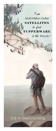
The Overlook Crowders Mountain State Park 35 13 54 2302 N 81 16 25 9136 W On May 3 2000 Dave Ulmer hid the first geocache GPS Stash in Oregon to test the high accuracy GPS satellites recently made available to all by the government Posted Coordinates N 45 17 460 W 122 24 800 Lots of goodies for the finders Look for a black plastic bucket buried most of the way in the ground Take some stuff leave some stuff Record it all in the log book Have Fun I use Multi Million Dollar SATELLITES to find TUPPERWARE in the Woods By the end of the month the stash was referred to as a geocache Geo j Relating to the Earth Cache kaSH a collection of items of the same type stored in a hidden or inaccessible place GASTON GIS gis gastongov com GIS in Geocaching
COORDINATES Coordinates determine the location of any place on earth Latitude Y are horizontal lines that measure the distance North or South of the Equator Longitude X are vertical lines that measure the distance East or West of the Meridian Geocaching uses coordinates to mark the location of the cache Explorers hunt for treasure using a GPS enabled device to find a specified set of coordinates Once you find the hide make a log entry and claim the treasure Don t forget to leave something for the next explorer There are several formats in which coordinates may be written The center of Gaston County may be written as Decimal Degrees 35 262283 N 081 187538 W Degrees Minutes Seconds 35 15 44 219915 N 081 11 15 138265 W Latitude Longitude 35 262283 81 187538 GIS Geographic Information Systems A collection of computer hardware software and geographic data for capturing storing updating manipulating analyzing and displaying all forms of geographically referenced information WGS84 World Geodetic System 1984 WGS84 Web Mercator is the standard for digital mapping and online services WGS84 is the datum for GPS A datum is the reference point axis or plane in which all other map data is based on Web Mercator is a variant of the Mercator map projection A projection is the method of representing the curved surface of the Earth on a flat map Vector data is the most common type of data created in GIS It is symbolized as points lines and polygons Each point represents a coordinate location A single point may be an address or notable place A series of points are connected together to create a line A line may be a street or stream Areas like parks are best represented as a polygon Raster data is a matrix of pixels or cells that create a image Each cell represents a known spatial resolution Most people are familiar with this as an aerial or satellite map GPS Global Positioning System GPS provides positioning navigation and timing by using satellites in the Earth s orbit A GPS receiver listens to these satellites to find an exact location GPS receivers generally fall under three 3 categories Recreation Grade Map Grade Survey Grade Smartphones use a combination of GPS WiFi and Cell Towers for location