Return to flip book view
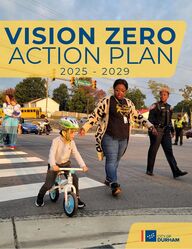
VISION ZEROACTION PLAN2 0 2 5 - 2 0 2 9 Message
We can create a future where no onedies or is seriously injured in atraffic crash in Durham.About every month in Durham, twopeople die in traffic crashes. Trafficdeaths force families, friends andcommunity members to remembertheir loved ones rather than spendtime with them. It does not have tobe this way.This plan is dedicated to theirmemory and to building a safer cityfor everyone.
Tyrone, 51Danny, 57Brittany, 20Frances, 68Leon, 28Cesar, 31Marvin, 18Zaena, 22Salvador, 44Christina, 39Brooke, 24Kwan, 41Donald, 47Jeremy, 34Laquinton, 30Anthony, 51Mary, 80Osiel, 33Tommy, 70Roger, 57Isaac, 22Ernest, 86Barbara, 75Edgar, 23Billie, 81David, 29Manuel, 55Leydi, 35Danielle, 30Shyhiem, 22Ashley, 24Carlos, 27Bruce, 34Kenneth, 43Nathan, 35Victoria, 26Willie, 60Jarrein, 21Kevin, 40Xavier, 32Antonio, 24Jacob, 28Raekwon, 24Miguel, 23Oscar, 54Kevin, 27Robert, 48Durrall, 15Donna, 56Jeremiah, 1Lashawn, 43Sandra, 52Cameron, 41Juan, 25Kalon, 25Courtney, 23Gabriella, 20Elijah, 22Kelvin, 33Arthur, 62Benito, 44David, 52Daryl, 37Tysiea, 45David, 54Alex, 26Imoni, 21Omar, 19Kenneth, 28Rita, 73Everado, 28Alicia, 48Eddie, 50Jasmine, 29Briseida, 20Bowen, 26Steven, 50Shanelle, 40Darion, 28Jeffrey, 72Jamez, 33Zack, 45Douglas, 46Jabari, 21Michael, 60Andrew, 27Andrea, 56Cornisha, 24Joseph, 23Hector, 45James, 35Osvaldo, 57Meliss, 56Deborah, 66Robin, 42Monty, 57Sheryl, 66Porcia, 19Michael, 32Timothy, 19William, 50Demeico, 20Wiliam, 17John, 63Matthew, 34Harold, 59Dejan, 24John, 51Gaynor, 73Gregory, 53Amanda, 22Brandon, 33Khadyfe, 18Terrell, 51Frankie, 36Khalil, 31Deryl, 37Jackie, 50Dean, 61Yessika, 21Michael, 67Edilberto, 52Donna, 78Miriam, 27David, 38Shon, 30Joshua, 23 Greg, 51 Aretha, 49 Jerry, 28 Gonzalo, 22 Jose, 25 Victoria, 62 Umar, 30 Michela, 22 Brandon, 24 Patrick, 26 Tyrone, 44 Nicholas, 29 Tawanda, 50 Santos, 42 Myiah, 18 Phillip, 72 Aaron, 46Lena, 65Reginald, 41Ryan, 40Johnathan, 33Sherod, 29Alexander, 42Gabriel, 27Edward, 45Fredrick, 30German, 22Randy, 28Thomas, 42Holly, 34George, 21*The names above are people who died in reported traffic crashes in the City of Durham from 2017-2023.
Every year, lives are needlessly lost and families are forever changed due to traffic crashes onour streets. These are preventable tragedies that deeply impact the lives of too many of ourneighbors. And in Durham, we refuse to accept traffic deaths and serious injuries as inevitable.That’s why we are committed to Vision Zero—not just as a statement, but as a call to action.Durham is a city built on the pursuit of justice. Too often, our most vulnerable residents—thosewalking, biking, using mobility aids, or relying on public transportation—bear the greatestburden of an unsafe transportation system. In fact, one in every four people killed in a crash inDurham is a pedestrian. These disparities are unacceptable. No one should risk their life bysimply walking in their own community. Addressing this crisis is not just about road design; it isabout equity, access, and the fundamental right to move safely through our city.This Vision Zero Action Plan is more than words. It is a commitment to change—one that willrequire bold decisions, multiagency implementation, and the courage to challenge outdatedapproaches that have not prioritized safety. Many of Durham’s most dangerous roads are notmaintained by the City, but that cannot be an excuse for inaction. We will work with ourpartners to push for the policies, funding and street designs that put people first. It will takebetter land use policy, investments in transit, redesigning streets, and ensuring that everyneighborhood, regardless of zip code, benefits from life-saving improvements.Together, we can create a Durham where no one has to fear for their life while traveling to work,school, home, or the grocery store. A Durham where families can safely walk to parks, whereresidents can bike to their favorite restaurant, and where everyone—no matter how they getaround—can fully enjoy all that our city has to offer.This work is not a snapshot, but a lifestyle. Let’s build a safer, more just Durham, together.In Service and Gratitude,Leonardo WilliamsMayor of DurhamA MESSAGE FROM MAYOR LEONARDO WILLIAMS
City of Durham Flickr, 2024WHERE WE ARE & WHERE WE’RE GOINGOverview8Implementing this Action Plan12TRAFFIC SAFETY IN DURHAMCommunity Feedback13Crash Data15Team Guidance19VISION ZERO ACTIONS & PRIORITIESPriorities21Actions22NEXT STEPSFuture Opportunities32APPENDIXWork Plans to Support Action Implementation35
6City of Durham Flickr, 2024VISION ZERO WHERE WE ARE & WHERE WE’RE GOING
Fatal Crashes Serious Injury Crashes20142015201620172018201920202021202220230102030405060701624184614282433254623472963185825662644The fatal crash rate in Durham has continued to increase since 2014*VISION ZERO: WHERE WE AREDurham has the tools to improve safety. Since 2017, Durham hasInstalled 20 miles ofbikeways including 7 milesof neighborhood routesFilled nearly 12 miles ofsidewalk gapsEnhanced pedestrian safetyat 15 intersections byrestricting red right-turns Implemented over 20 flexibleinstallation projects to improvesafety on neighborhood streetsIn 2024, the City reinvigorated its Vision Zero commitment by setting a target date to achievezero traffic deaths and serious injuries and adopting a proactive public health approach to theepidemic of traffic violence. Traffic deaths and serious injuries have significant physical, social,and economic impacts. Because transportation is key determinant of health, we must apply apublic health framework to prevent these harms and create a safer system for all.7In 2017, the City of Durham (the “City” or“Durham”) committed to Vision Zero, agoal to end traffic deaths and seriousinjuries. Vision Zero is used throughoutthe world to study, collaborate, andimplement solutions to improve streetsafety for everyone. Yet, people in Durham continue to losetheir lives in traffic crashes. In the span of10 years, an average of 22 people havebeen killed and 46 have been criticallyinjured annually in crashes in Durham.These tragedies are often referred to as“accidents,” but they are preventable.*Year Range: Fatality Rate (Normalized by Population), Population (Year) 2014-2018: 6.7, population 275829 (2018) ; 2019-2023: 8.2, population 296186 (2023)V I S I O N Z E R O : W H E R E W E A R EWhile Durham has implemented safety measures, systemic issues remain. Most traffic deathsand serious injuries happen on certain roadways, highlighting the need for a focusedapproach on the High Injury Network.
74%of fatal and severe injury crashes occur on just10% of Durham’s roads. These roads form theHigh Injury Network**Crash data from 2016-2023; Excludes major freeways I-85; I-885; I-40; Durham Freeway 147, and 15-501¹
VISION ZERO: WHERE WE ARE GOING9Adopting a Safety StrategyThe Vision Zero Action Plan is the City of Durham'sfirst roadmap to reduce traffic deaths and seriousinjuries by 50% by 2035 and eliminate deaths andserious injuries by 2045. The plan uses transportation data and input frommultiple City departments, partner agencies, and thepublic to define and prioritize the most impactfulactions that the City and its partners can take toeliminate traffic deaths and injuries by 2045.Community FeedbackThe Durham community continues toexpress their top concerns related to trafficsafety, collected through the Vision ZeroInput Map available online and on paper. Insummer 2024, City staff attended 12community events to share the Input Mapand discuss traffic safety concerns. Durhamresidents logged over 550 comments. Topconcerns include lack of sidewalks, speed,failure to stop for pedestrians and no safecrossings. Most people experience trafficsafety issues while walking in Durham(49%), 26% while driving, 16% while biking,and 9% while other*.Crash DataThe High Injury Network helps to target resources where the need is highest. A review of crashdata in the City of Durham from 2017-2023 helps to understand the causes and consequencesof severe and fatal crashes.Who is Being Disproportionately Impacted?Black people account for 36% of Durham’s population, but they account for 53% of seriousinjuries and 49% of fatalities in traffic crashes.Pedestrians are involved in 2% of all crashes yet 18% of serious injury crashes and 26% of fatalcrashes.What Crash Types, Factors, and Built Conditions are Contributing to Deaths and Injuries?Drivers who hit pedestrians and drivers who run off the road account for nearly 50% of fatalcrashes.80% of pedestrian fatalities occur during dark conditions.Speed is a contributing factor in 31% of fatal crashes.9% of Durham’s roadways are more than two lanes yet account for 59% of fatal crashes.V I S I O N Z E R O : W H E R E W E A R E G O I N GCity of Durham staff engage with attendees at theDurham Pride Pop-Up Market in Fall 2024*While riding or waiting for the bus, riding a scooter or other mobility device, or observing from home
10Best PracticesDurham’s Vision Zero strategy focuses on transportation and public health as a system, recognizing thesignificant influence of transportation on socioeconomic outcomes like access to education and jobs. Itprioritizes actions that tackle root causes of severe crashes and focuses on solutions that improve healthand safety at the population-level, as illustrated in the Safe Systems Pyramid.²The Safe Systems Pyramid is modeled after the Health Impact Pyramid, an action-oriented publichealth framework to improve health outcomes. Implementing interventions further down the pyramidis likely to increase the size of the population exposed to protective factors and require less individualeffort. By prioritizing interventions at the base of the pyramid, Durham ensures life-savingimprovements benefit everyone, just as staff, partner agencies, and the community have urged.VISION ZERO: WHERE WE ARE GOINGTeam GuidanceIn 2024, City staff, partner agencies, local groups, and community members came together to explorewhy street safety must be a priority in Durham and how we can achieve it. We heard that street safetyis essential for equitable, inclusive transportation, a healthier, more livable, and economicallysustainable Durham, and a City dedicated to protecting lives over convenience.To achieve these outcomes, we heard a call for actions that address transportation and land usepolicy, safer infrastructure, and community engagement efforts that are fun and educational. Wealso heard a need for stronger agency coordination and a desire for Durham to embody a culture ofsafety. These actions, embodied in the Safe Sytems Pyramid, form our strategy for Vision Zero.Posterboards from Fall 2024 Vision Zero Workshop show sticky dots on actions deemed most impactful for street safety
VISION ZERO: WHERE WE ARE GOING11Prioritizing a Safety Strategy to Achieve Zero Traffic Deaths and Serious InjuriesCombining team guidance, crash data, community feedback, and the Safe Systems Pyramid, the City ofDurham’s Vision Zero Strategy focuses on six key actions: Land Use Policy Update, Street Design PolicyManual, Built Environment Assessments, Rapid Street Improvements, Safe Speed Strategies, and TrafficSafety Insights. These actions are grouped by their connection to the Safe Systems Pyramid and informeach other, as indicated in the feedback loop figure below.Implementing this Action Plan means:Prioritizing Improvements on the High Injury Network: The City of Durham commits totargeting corridors that account for the most traffic deaths and serious injuries. By prioritizingthe High Injury Network, we can focus resources on areas where safety improvements have thegreatest benefits relative to costs, saving lives and protecting our most vulnerable road users.Establishing Dedicated Funding for Vision Zero: The City of Durham prioritizes capitalinvestments to update roadway designs, particularly in the High-Injury Network, to achieveVision Zero goals. Consistent funding for major roadway safety projects is critical to implementand sustain strategies that will transform our streets and save lives.Allocating Sufficient Staffing to Support Vision Zero Implementation: The City of Durhamprovides dedicated staffing resources, across departments, to ensure effective execution andongoing management of these life-saving initiatives, reinforcing our commitment to a saferDurham.
TRAFFIC SAFETYIN DURHAMCity of Durham Flickr, 2024
COMMUNITY FEEDBACKIn 2024, City staff launched the Vision Zero Input Map and attended community eventsthroughout Durham to learn more about where people have traffic safety concerns. Peopleshared locations, including streets and intersections, where they experience a variety of safetyissues while walking, biking, driving, or using the street in other ways like waiting for the bus.*While riding or waiting for the bus, riding a scooter or other mobility device, orobserving from homeGathering feedback at the Saturday Farmers’ Market in Durham Central Park13Gathering feedback at Durham Pridecomments collectedand mapped+550communityevents12When asked about traffic safetyconcerns in Durham, mostpeople expressed concernsabout walking.0 10 20 30 40 50WalkingDrivingBikingOther*49%26%16%9%
*Includes responses indicating seeing crashes/near misses, traffic signaltiming, wrong-way driving, and congestion that leads to unsafe drivingmaneuvers.14TOP SAFETY 1. Speeds3. Other*2. No Sidewalk5. No Safe CrossingMAPPED BY THE COMMUNITYCONCERNS4. Failure to Stopfor PedestriansGathering feedback at Durham Fiesta LatinaGathering traffic safety feedback at Durham Station during micromobility eventGathering feedback at a Back to School Block Party at Heritage Square in HaytiCOMMUNITY FEEDBACK
Black Hispanic White Asian American Indian Other010203040506036405349151417194032243162 211032 20 5 10 15 20 25 30PedestriansMotorcyclistsBicyclists2182611318012CRASH DATA15*Charts rounded to nearest whole percentageBlack and Hispanic Residents Face Disproportionate Crash ImpactsVulnerable Road Users are Over-Represented in Fatal CrashesPeople walking, biking, or usingmotorcycles (Vulnerable RoadUsers) face a higher risk of injury ordeath in traffic crashes. Exposure tomotor vehicles is higher and severeinjury is more likely for these roadusers. Between 2017 and 2023, 1 in4 fatal crashes involved aVulnerable Road User.Percent of Total CrashesPercent of Serious Injuries Percent of FatalitiesCrash analyses represented in this section include crash reports documented by lawenforcement agencies between 2017-2023 in the City of Durham, unless otherwise noted.Crashes that do not involve motor vehicles, such as those between a train and a pedestrian, arenot included.Percent of Total PopulationPercent of Serious InjuriesPercent of FatalitiesPercent of Persons in All Crashes
Angle Run Off the Road Left Turns Hitting Pedestrians Hitting Fixed Object Head On0510152025302422107172349122182624 419811531214151109CRASH DATAPercent of Total Crashes Percent of Serious Injuries Percent of FatalitiesPercent of Total CrashesPercent of Serious InjuriesPercent of FatalitiesLeft turn maneuvers, hitting fixed objects, and head on collisions are also over-represented infatal and serious injury crashes. Angle-type crashes where a driver hits another driver at anangle (e.g. “t-bone”) account for the highest percentage of serious injury crashes but this is anunder-representation compared to all angle-type crashes. Notably, angle and left-turn crashtypes may be reported inconsistently because both involve drivers colliding at an angle, thoughone is specifically related to turning movements.of all fatalitiesinvolved speedingas a contributingfactor31%16*Charts rounded to nearest whole percentage; based on crashes with contributing factors identifiedDrivers Who Hit Pedestrians and Drivers Who Run Off the Road account for nearly50% of Fatal Crash TypesExceededAuthorized SpeedLimitReckless,AggressiveDrivingCrossedCenterline/ GoingWrong WaySpeeding, Recklessness, and Wrong-way Maneuvering Contribute to a Majority ofFatalities
CRASH DATA17Intersections &Corridors*at/near = within 100ft; signalized intersection = a stop and go traffic signalIntersections are areas of potentialconflict where drivers and morevulnerable road users like pedestriansand bicyclists interact. Corridors canprovide opportunities for drivers tomaneuver dangerously, depending onhow they are designed.43% of pedestrian fatalities occurrednear intersections (40% of which aresignalized*)40% of left-turn crashes resulting ina fatality occurred at signalizedintersections*71% of fixed object crashes resultingin a serious injury occur on two laneroads56% of run-off-road crashesresulting in a fatality occur onmultilane roadsThe built environment significantly influences crash severity. Intersections with multipleconflict points, high-speed corridors, poor lighting, and suburban land uses correlate withserious injuries and fatalities.Lighting Conditions Appropriate street lighting provides bettervisibility for all road users and increasesvisibility of more vulnerable road users.Streets with poor or no lighting canincrease the likelihood of severe crashes.80% of pedestrian fatalities occurredduring dark conditions59% of angle crashes resulting in afatality occurred during dark conditions62% of head-on crashes resulting infatality occurred in dark conditions56% of run-off-road crashes resulting infatality occurred in dark conditionsDevelopment patterns, like housinglocation and type, influence roadwaydesign and connectivity. A lack of safeconnections can increase the likelihood ofsevere and fatal crashes.62% of serious injury crashes and 64%of fatal crashes occur in suburbancontexts, while the remaining occur inurban and downtown contextsLand Use
CRASH DATAHigher Speed Limits and Multi-lane Roadways are Over-Represented in Fatal andSerious Injury CrashesSpeed is a central factor in determining the severity of a crash. Crashes that occurat higher speeds are exponentially more likely to result in a fatality or severeinjury. Roads with multiple travel lanes are also more likely to encourage highertravel speeds and can be difficult to cross for pedestrians.18Percent of Street Network Percent of Fatal Crashes40519438540959332752443535 mphTwoLanesMore thanTwo LanesGreater than 35mphGreater than 35mph and Morethan Two Lanes*Charts rounded to nearest whole percentage, excludes major interstates35 mph andMore thanTwo Lanes35 mph andTwo Lanes
TEAM GUIDANCE19In 2024, City staff, partner agencies, local groups and community members came together aspart of the Vision Zero Working Group (p. 39), Vision Zero Coalition (p. 39), and Vision ZeroWorkshop to explore why street safety must be a priority in Durham.A Healthier, More LivableDurham“To improve the experienceand well-being of ourresidents.”“Safe streets promotemultimodal transportation &healthier living.”Equity and Inclusivity inTransportation“To provide choice of mobilityfor all.”“Because I want my kids andaging parents to have freedomto get around.”A Dedication to ProtectLives“The people we serve deserveto feel safe and protected.”“So everyone in Durham canhave equitable access toresources and opportunities.”“Because people live and workhere, and their lives areimportant.”“Because one preventabledeath is too many.”To achieve these outcomes, we heard a call for actions that are rooted in the Safe SystemsPyramid and local Durham context: stronger Agency Coordination, such as throughpartnering agreements, and creating a Culture of Safety that puts people’s protection andwell-being first. These priorities will be woven into Policy, Safe Infrastructure, and CommunityEngagement strategies that we heard are integral to achieve lasting, life-saving change.Complete Streets &integrate in land usecodeBetter lighting, morevisible crosswalksSpeed managementplanStart by asking thecommunity, thosemost impactedWalkable streets, allroads havesidewalksRoad diets,narrowerlanes/streetsTactical urbanismguidelinesBetter education,reporting, &storytellingCompletemultimodalnetwork, withamazing transitBetter lighting, morevisible crosswalksMore quick-builddemonstrationprojectsNeighborhood-empowered trafficcalming, safetyauditsDedicated fundingfor Vision ZeroimplementationDaylighting,protectedintersections,roundaboutsRaised crosswalks,physical trafficcalmingMake it fun! HostOpen Streets &demo projectsPOLICY SAFE INFRASTRUCTURE ENGAGEMENT“So connecting withcommunity doesn’t requirerisking your life.”
20VISION ZERO City of Durham Flickr, 2024ACTIONS & PRIORITIES
VISION ZERO PRIORITIESDrawing on community feedback, crash data, including the High Injury Network, and team guidance, wedefine six key actions for implementation that mirror the Safe Systems Pyramid framework.21Socioeconomic factors shape our Policy initiatives, while improvements in the built environment andboth latent and active safety measures align with our Safe Infrastructure efforts. Traffic safety educationis embedded in Community Engagement, along with reporting and evaluation. Robust AgencyCoordination spans every area. These strategies elevate improving community-wide benefits, includingmaximizing the health of our population, while reducing reliance on individual effort, ultimately creatinga Culture of Safety.The six priority actions lay the foundation for Durham to be a healthier and more livable city, rooted in acommon ethic to protect lives, and where life-saving improvements benefit everyone, just as ourcommunity has urged. The actions also align with local and regional plans and policies.Complimentary Plans & PoliciesDurham Comprehensive Plan establishes a transportation goal for Durham residents to have safe,affordable, dignified, sustainable, connected, and physically accessible transportation by 2050 andoutlines growth management strategies, including 15-minute communities.Triangle West Transportation Planning Organization Regional Safety Action Plan outlines safetyactions that focus on land development practices and procedures, roadway safety resources andguidance, multimodal safety, traffic calming, and high-speed corridors.City of Durham Vision Zero Resolution (#10341) commits to use a Safe Systems approach to reducetraffic deaths and serious injuries by 50% by 2035 and eliminate traffic deaths and serious injuries by2045.City of Durham NACTO Resolution (#10353) commits to use National Association of CityTransportation Official (NACTO) design guidance as the official street design guides for the City ofDurham and update land use standards accordingly.
2Create a Street DesignManual that SetsStandards for BetterStreetsUpdate Land Use andZoning Code to ReduceVehicle Miles Traveledand Prioritize Safety15Develop and EnforceCitywide SpeedManagement Plan3Develop Road SafetyAudit Program andImplement SafetyRecommendations4Implement quick-buildprojects that reducespeeds and increasesafe pathways to walk,bike, or access transit6Share Traffic SafetyUpdates and HighlightResident Impact22VISION ZERO ACTIONSTraffic deaths are linked to how much people drive, soreducing Vehicle Miles Traveled (VMT) saves lives³.Dense, mixed-use land use patterns and betterroadway networks can reduce VMT.⁴Street design that reduces vehicle speeds and drivingexposure has the greatest safety impact⁵. Standardizingproven safety countermeasures can reduce fatal andserious injury crashes by 15-82%.⁶Road Safety Audits result in formalizedrecommendations, with multidisciplinary buy-in, thatcan reduce total crashes by 10-60%.⁷Implementing street changes more rapidly can slowvehicle speeds and decrease conflicts between driversand more vulnerable road users, reducing the risk ofdeath and serious injury for all road users.⁸Reducing vehicle operating speeds decreases seriousand fatal injuries resulting from traffic crashes.⁹Road safety campaigns can change perceptions andreduce crashes.¹⁰ ACTIONS HOW THEY CAN ACHIEVE ZERO
ACTION 1. UPDATE LAND USE POLICY23HELPS TO ACHIEVE VISION ZERO BY: Reducing VMT, which is correlated with traffic deaths³Update Durham’s land use ordinance and guidelines to reduce Vehicle Miles Traveled (VMT) and align withthe City’s Comprehensive Plan by:KEY OUTCOMES:The City’s Unified Development Ordinance(UDO) will have updated street cross-sectionsand standards that prioritize safety of vulnerableroad users who walk, bike, and use a mobility aid.The City will develop a comprehensivemultimodal infrastructure assessment, in placeof the Transportation Impact Analysis, thatincreases multimodal connectivity and curbsprojected VMT growth.The City’s UDO will have better designstandards for transit opportunity areas, such asoptimized building setbacks, parking placement,and multimodal infrastructure.The City will explore land use practices thatreduce VMT and support Durham’sComprehensive Plan (“Comp Plan”), amendingthe UDO and other land use guidelines asnecessary.AGENCIES INVOLVEDLead: City & County of DurhamPlanning; City of Durham PublicWorks, TransportationSupport: City of Durham Mayor’sCommittee for Persons withDisabilities; Durham CountyTransportation; NCDOTBENCHMARKUnified Development Ordinance isupdated and adopted with newstreet standards that prioritize safety.Increased multimodal connectivityresults in reduced VMT.ESTIMATED TIMELINEShort-termOngoing, completion early 2026Aligning land use standards with nationally recognized street safety practices that prioritize thesafety of vulnerable road users¹¹Creating a comprehensive multimodal infrastructure assessment for new development thatincreases multimodal connectivityDeveloping transit opportunity zone standards that optimize land use and multimodal infrastructureA person sitting on a bench at a sheltered bus stop while holding their bikeand bike helmet.
ACTION 2. CREATE STREET DESIGN MANUALPeople biking and rollerblading in the street during Bike, Walk, and Roll toSchool Day for E.K. Powe Elementary.24HELPS TO ACHIEVE VISION ZERO BY: Decreasing conflicts between drivers and more vulnerable road users whowalk, bike or use a mobility aid. Reduced exposure to driving has the strongest relationship with improved safety.⁵KEY OUTCOMES:The City will have a Street Design Manual withcomprehensive street typologies linked to theUnified Development Ordinance. Othersupporting guides may be updated, such as theReference Guide for Development. The City will map street typologies for allexisting and future roadways, ensuring streettypes prioritize the safety of more vulnerable roadusers, incorporate land use context, and integratecitywide and neighborhood goals.The Street Design Manual will have standardsthat align with Complete Streets and VisionZero principles and allow for innovative andflexible design modifications that maintainvulnerable road user safety as the priority.The Street Design Manual will have clearprocesses for retrofitting streets, maintainingstreet functions during construction, andprioritizing safety on state-maintained roads.AGENCIES INVOLVEDLead: City of Durham Public Works,Transportation; & City & County ofDurham PlanningSupport: City of Durham Fire, GeneralServices, Parks & Recreation; Mayor’sCommittee for Persons withDisabilities; Durham CountyTransportation; Triangle WestTransportation Organization; NCDOTBENCHMARKStreet Design Manual is finalized andadopted by 2028.New/retrofitted streets result inreduced conflicts between road users.ESTIMATED TIMELINELong-termKick-off 2026Develop a street design manual that:Serves as an adjunct to the Unified Development Ordinance (UDO), linking land use andtransportationCreates street typologies based on land use context and protecting more vulnerable road usersSets technical specifications for the construction of new streets and the reconstruction and retrofit ofexisting streets that align with Complete Streets and Vision Zero principles
ACTION 3. CONDUCT SAFETY ASSESSMENTSKEY OUTCOMES:The City will prioritize and implement RSArecommendations on HIN corridors and assesssafety on streets near schools that are near HINcorridors.The City will use established RSA frameworksto perform safety audits, document existingconditions, and identify safety recommendationsin formal RSA reports with multiagency buy-inthat will be made available to the public.The City will use proven safety countermeasuresand pilot treatments to address over-representedcrash types and factors in fatal and serious injurycrashes, and identify solutions that are quick-buildand long-term.The City will create a pipeline of safety projectssupported by formal reports that document data,existing conditions, and recommendations, ensuringthat projects are design ready. AGENCIES INVOLVEDLead: City of Durham Police &TransportationSupport: City of Durham Fire, Parks &Recreation, Public Works,Neighborhood Improvement Services;Mayor’s Committee for Persons withDisabilities; Durham County PublicHealth, Transportation; Triangle WestTransportation Organization; NCDOTBENCHMARKRoad Safety Audits are conducted ata minimum 10 locations each year.Improvements result in speed andcrash reductions.ESTIMATED TIMELINEShort-termKick-off mid 2025Members of the Vision Zero Workshop safety audit talk to communitymembers along Mangum St.Build an interdisciplinary team to conduct in-person road safety audits (RSAs) that:Identify safety issues and opportunities on High Injury Network (HIN) corridors and around schoolsnear HIN corridorsUse frameworks established by the Federal Highway Administration (FHWA) proven safetycountermeasures and North Carolina Pedestrian and Bicycle Road Safety AssessmentCreate formal reports to develop a pipeline of safety projects for funding and implementationHELPS TO ACHIEVE VISION ZERO BY: Using safety designs to reduce the number of severe crashes by 10-60%.⁷25
ACTION 4. IMPROVE STREETS RAPIDLYKEY OUTCOMES:The City will have a Quick-Build toolkit andpolicy for implementation with low-costmeasures to address common crash types andcontributing factors in severe crashes. The Quick-Build toolkit and policy will establishcriteria for eligibility, focusing on pedestrian andbicyclist network needs, crash history and risk,and feasibility of quickly implementing, flexibleinstallations that slow speeds, calm traffic, andreduce conflicts between road users. The Quick-Build toolkit will outline volunteer-supported efforts that may be used toimplement, maintain, and evaluate certain safetyelements, making it easier for communitymembers to experience new and unfamiliarstreet designs.The City will dedicate funding toward a quick-build safety program which supports the design,construction, and evaluation of projects to swiftlyaddress safety needs Citywide.AGENCIES INVOLVEDLead: City of Durham TransportationSupport: City of Durham Fire, GeneralServices, Neighborhood ImprovementServices, Public Works; DurhamCounty Public Health, Transportation;NCDOTBENCHMARKQuick-Build toolkit and policy isadopted by mid-2026.Projects result in reduced speeds orsevere crashes and increase inped/bike activity. ESTIMATED TIMELINEShort-termKick-off late 2025Asphalt art project at the intersection of Club and Glendale outside of ClubBoulevard Elementary SchoolEstablish a quick-build program that:Creates a “toolkit” and implementation policy for pre-approved, quick-build safety countermeasures Defines project selection, evaluation, and outreach methodsImplements and evaluates quick-builds with community involvement and supportHELPS TO ACHIEVE VISION ZERO BY: Implementing street changes more rapidly that slow vehicle speeds anddecrease conflicts, reducing risk of death and serious injury for all road users.⁸26
ACTION 5. MANAGE SAFE SPEEDSKEY OUTCOMES:The City will have a Speed Management Planthat prioritizes safety over speed, withguidelines to reduce speed limits Citywidebased on best practices that use several factorssuch as land use context, roadwaycharacteristics, crash history and risk/likelihoodof a severe crash.The Speed Management Plan will offerconsistent and context-sensitive approaches,such as default speed limit reductions, slowzones, and corridor speed limits.Speed Management techniques will includepilot measures and physical changes thatenforce newly recommended speed limits insensitive areas or when before/after datasuggests non-compliance.The City will advance a formal traffic calmingpolicy, informed by speed managementtreatments, which may incorporate elements ofthe existing traffic calming guidelines and speedhump policy.AGENCIES INVOLVEDLead: City of Durham Police,TransportationSupport: City of Durham Fire,Neighborhood Improvement Services;Durham County Transportation,Triangle West TransportationPlanning Organization; NCDOTBENCHMARKSpeed Management Plan is finalizedin 2028.Changes result in reduced speedsand severe crashes, or both.ESTIMATED TIMELINEShort-termKick-off early 2027City of Durham staff implementing a 25mph pavement marking on a street,next to a 25mph speed limit signHELPS TO ACHIEVE VISION ZERO BY: Reducing vehicle operating speeds which decreases serious and fatalinjuries resulting from traffic crashes.¹⁰Develop guidelines for setting and reducing speed limits citywide that:Prioritize safety of all road users over traffic flowUse best practice models which incorporate several variables to determine safe and prudent speedlimits¹²Deploy pilot measures and physical changes to improve compliance with new speed limits wherespeed management is most urgently needed27
ACTION 6. SHARE TRAFFIC SAFETY INSIGHTSKEY OUTCOMES:The City will promote and publish annualVision Zero progress reports with updates onaction plan items, safety projects, and relevantdata. The City will have an online, interactive datadashboard for public use featuring traffic safetydata, transportation projects, and key metricsrelated to Vision Zero, updated at least quarterly. Community members, and their safety stories,will be featured on the data dashboard andreports, with opportunities to developcommunity-led data uploads and feature storiesthat encourage a culture of safety.The data dashboard will become a centralizedhub for project updates on traffic safety inDurham, with commitments from contributingagencies to report regular project updates.AGENCIES INVOLVEDLead: City of Durham TransportationSupport: City of Durham GeneralServices, Neighborhood ImprovementServices, Police, Public Works;Durham County Public Health;Triangle West TransportationPlanning Organization; NCDOTBENCHMARKData Dashboard is published in 2025.Reporting opportunities result inincreased visits to Vision Zero website.ESTIMATED TIMELINEShort-termOngoing; dashboard in developmentA community member shares their story at a Ride of Silence eventcommemorating victims of traffic violenceHELPS TO ACHIEVE VISION ZERO BY: Increasing awareness of traffic safety problems, which can have apositive impact on road safety.¹¹Create traffic safety reporting mechanisms and platforms, including a Vision Zero Data Dashboard, to:Share traffic safety data broadly and regularlyProvide consistent project updates related to transportation safety improvements Highlight safety stories from the community in educational and engaging ways, such as smallcommunity events to celebrate completed projects28
NEXT STEPSCity of Durham, Vision Zero Workshop Safety Audit
HOW DOES THIS ALL WORK TOGETHER?30The six priority actions are proposed to kick-off in the next three years with varying milestonesand implementation timelines. The actions will inform one another, as demonstrated in thefigure above. The chart below shows a broad overview of when they are estimated to start,overlap, and get on the ground. For a more detailed overview of Action Item implementationsteps and timelines, please see Appendix - Work Plans to Support Action Implementation.
Durham has the roadmap. Now, we must work together to make Vision Zero a reality. The sixkey actions outlined in this plan—Updating the Land Use Code, Creating a Street DesignManual, Conducting Road Safety Audits, Implementing Quick-Build Projects, Developing aSpeed Management Plan, and Sharing Traffic Safety Statistics & Stories—are just thebeginning. Real progress requires sustained political will to prioritize safety over convenience. Elected Officials & City Leadership: Commit to Bold ActionDurham needs dedicated local funding and strong policies to make Vision Zero a lasting priority.Leadership must push forward people-first policies, redesign streets for the most vulnerable, andchallenge outdated transportation norms. This means embracing innovation, creating systemic change,and ensuring safety is at the top of Durham’s future budgets and decision-making.Partner Agencies: Unify the Approach to Safer StreetsSome of Durham’s deadliest roads are maintained by state transportation partners. Improving safety onthese streets requires stronger coordination and better mandates to implement improvements thatprotect all road users and prioritize safety over vehicle throughput. With best-practice design standardsand dedicated funding for infrastructure that slow vehicle speeds and physically separate morevulnerable road users, we can achieve zero traffic deaths and serious injuries. Local Organizations & Businesses: Keep Demanding Safe Streets Safe, walkable, bikeable streets boost economic activity, improve access, and foster a stronger, healthierDurham. Businesses and local organizations can champion infrastructure projects that support safer,more accessible streets. Whether through education, collaboration, or advocacy, these partnershipsstrengthen the City's ability to create a more connected and thriving community.31Community Members: Your Voice MattersEvery resident has a role to play in making Durham’s streetssafer. Report dangerous conditions, show up at publicmeetings, support policies that protect vulnerable roadusers, or join a local group to advocate for safe streets—small actions add up. Change happens when communitiesdemand it. Moving Forward TogetherDurham’s commitment to Vision Zero is more than a policy—it is a responsibility to protect lives. Every action we takebrings us closer to a city where no one has to fear for theirlife while moving through their community. By workingtogether, we can build a safer, more equitable Durham.Use the Vision Zero Mapto tell us your safetyconcernswww.durham.gov/995/Vision-ZeroCALL TO ACTION: MAKING VISION ZEROA REALITY
Safe System PyramidAlignmentFuture OpportunityCommunity Engagement/EducationUpdate City of Durham outreach materials to include Vision ZeroOrganize citywide engagement events to promote traffic safetyAdd Vision Zero into City of Durham new employee orientationProvide City of Durham defensive driving training with Vision Zero principlesTrain City staff and local media on framing traffic safety storiesWork with NC DMV to add ped/bike safety into driver trainingEquity & Community Safety/Active Safety MeasureDistribute reflective safety vests/ backpacks to unhoused individualsExpand existing programs for school crossing guards and child safety seat checksTrack and enforce safety in City fleet vehiclesPilot retrofits of City fleet vehicles with speed limitersSchool Safety/ SocioeconomicFactorsEstablish a “school area” policy to assess and implement street safetyimprovements within a certain radius of a schoolProcess & Legislative Changes/Socioeconomic FactorsChange City of Durham “Roadside Solicitation Rules” to align with Vision ZeroTransfer key state-owned streets to City control to improve project deliveryAdvocate for speed safety cameras and lower default speed limitsEstablish formal collaborative agreements on traffic safety prioritiesData & Monitoring/ AllInstall bike/ pedestrian counters to track activity trendsPartner with hospitals and law enforcement to improve crash data reportingThroughout the development of this Action Plan, ideas emerged that could furthersupport Vision Zero in Durham. This table highlights additional actions generatedduring meetings with the Vision Zero Working Group and Vision Zero Coalition andthroughout community engagement efforts, including a Vision Zero Workshop.These ideas could be pursued if capacity, funding, or policy changes allow. Over thenext five years, if these opportunities arise, the City will support them, but only afterthe six key actions are well underway, ensuring that core Vision Zero priorities remainthe focus.32FUTURE OPPORTUNITIES
33ACKNOWLEDGEMENTSAlexis John, Neighborhood Improvement ServicesBill Judge, TransportationChristopher Wilcox, FireClint Blackburn, Public WorksEvian Patterson, TransportationJames Cole, FireJack Romeyn, General ServicesJody Morton, FireJohn Ferguson, Fleet ManagementJonathan Bell, PoliceKimberly Delacruz, PoliceLeslie Tracey, TransportationMark Clancy, PoliceNeisha Reynolds, General ServicesPeter Nicholas, TransportationRyan Smith, Community SafetyScott Pennica, PoliceScott Whiteman, City and County PlanningShari Montgomery, PoliceStacey Poston, General ServicesTasha Johnson, Public WorksThomas Dawson, Parks and RecreationVizion Zero Working Group Members: Staff from 10 departments at the City of DurhamVision Zero Coalition Members: Advisory commission members, partner agencies, and community membersAllison Simpson, NC Vision Zero Task ForceAndrew Meeker, East Coast Greenway AllianceArohan Dutt, Community MemberAspen Romeyn, Community MemberBonita Green, Merrick Moore CDCCaleb Sponheim, Community MemberChris Perelstein, BPACDavid Bradway, Community MemberJason Bennett, Bike DurhamJavonna Rozario, Durham County Public HealthJohn Faulconer, Community MemberJohn Tallmadge, Bike DurhamJohn Zimmer, Community MemberKosta Grammatis, Community MemberKi Young Kim, Community MemberKrista Kicsak, Durham County Public HealthKristen Brookshire, Durham Public SchoolsMary Rose Fontana, BPACMatthew Palm, University/College staffMichelle Pendergrass, Durham Public SchoolsPhilip Sophocleous, Bike DurhamRebecca Bourgeois, Housing for New HopeShelisa Howard-Martinez, Aging Well DurhamTricia Smar, Duke Trauma CenterAndre Williams, City of DurhamBrian Taylor, City of DurhamBrooke Roper, Durham County TransportationChesney "Cole" Lassiter, City of DurhamChris Beasley, City of DurhamChris Smith, City of DurhamColleen McGue, Triangle West TPODylan Walker, City of DurhamDustin Robertson, Smart Growth AmericaEllen Beckmann, Durham County TransportationEmma Vinella-Brusher, City of DurhamEric Lagueruela, City of DurhamEric Simpson, City of DurhamEric Vitale, City of DurhamErin Convery, City of DurhamErin Kauffman, Durham Central ParkHannah Salvaggio, City of DurhamHyeseon Youm, City of DurhamJaibin Mathew, Smart Growth AmericaJavi Egan, Community MemberKenneth Enloe, City of DurhamLauren Grove, City of DurhamOther Contributors:Lawrence Fernandez, NCDOTLorenzo Wiley, City of DurhamNacarla Webb, City of DurhamRakea Joyner, City of DurhamTyler Fowler, NCDOTVision Zero Workshop attendees, including Mayor Williams, poseduring the bike safety audit
34Public Engagement LocationsThank you to the organizers and attendees of thefollowing events:Wednesday Farmers’ Market at Durham Central ParkPop-up at Durham StationSaturday Farmers’ Market at Durham Central ParkBasketball Camp at W.D. Hill Recreation CenterBlack Farmers’ Market at Durham Technical CommunityCollegeFiesta Latina at Durham Central ParkBack to School Event at The River ChurchMicromobility Launch at Durham StationBack to School event in HaytiVision Zero Workshop Open HouseMove-A-Bull at Durham Central Park ACKNOWLEDGEMENTS¹City of Durham Transportation Department, , Just Cities Collective, & Charlie Menefee. “Transportation EquityAction Plan”. 2025. www.durhamnc.gov/transportation.²Ederer, David J., et al. “The Safe Systems Pyramid: A new framework for traffic safety.” Transportation ResearchInterdisciplinary Perspectives, vol. 21, Sept. 2023, p. 100905, https://doi.org/10.1016/j.trip.2023.100905. ³“Fatality Facts 2017: State by State.” IIHS-HLDI Crash Testing and Highway Safety, May 2023,www.iihs.org/topics/fatality-statistics/detail/state-by-state.⁴North Carolina Department of Transportation, and Stantec. VEHICLE MILES TRAVELED REDUCTION STUDY. Dec.2024⁵Ferenchak, Nicholas N, and Wesley E Marshall. “Traffic Safety for All Road Users: A Paired Comparison Study ofSmall & Mid-Sized U.S. Cities with High/Low Bicycling Rates.” Journal of Cycling and Micromobility Research, vol. 2,no. 100010, 11 Jan. 2024, https://doi.org/10.1016/j.jcmr.2024.100010. ⁶Federal Highway Administration. “Proven Safety Countermeasures | FHWA.” Highways.dot.gov,highways.dot.gov/safety/proven-safety-countermeasures.⁷“Road Safety Audit | FHWA.” Dot.gov, 2025, highways.dot.gov/safety/proven-safety-countermeasures/road-safety-audit. ⁸U.S. Department of Transportation National Highway Traffic Safety Administration, et al. “Low-Cost PedestrianSafety Zones: Countermeasure Selection Resource.” July 2023.⁹National Highway Traffic Safety Administration. “Lower Speed Limits | NHTSA.” Www.nhtsa.gov,www.nhtsa.gov/book/countermeasures-that-work/speeding-and-speed-management/countermeasures/legislation-and-licensing/lower-speed-limits.¹⁰Robertson, Robyn D., and Charlotte R. Pashley. “ROAD SAFETY CAMPAIGNS: WHAT the RESEARCH TELLS US.” 10Nov. 2015.¹¹e.g. the National Association of City Transportation Officials (NACTO) design guides¹²e.g. National Association of City Transportation Officials (NACTO) City Limits, Federal Highway Administration(FHWA) USLIMITS2 and Speed Limit Setting HandbookCompiled in Coordination with the City of Durham byResources
Estimated Timeline: Short-termTaskDurationStatus/NotesTasks 1-55 monthsOngoing/ Part of current UDO updateTasks 6-75 monthsOngoing, completion 2026Tasks 8-92 monthsPart of biennial Comp Plan report card35APPENDIXWork Plans to Support Action ImplementationAction 1: Update Land Use PolicyForm a working group toupdate street designstandards in City ordinancesand guidelines¹1KEY TASKSUpdate ped, bike, and transitdesign standards to protectvulnerable road users4Use nationally recognizeddesign guides to informrequirements for saferstreets²2Share proposed updateswith the community toensure design align theneeds and vision5Create street cross sectionsw/ multimodal infrastructureto be applied Citywide3Identify street designelements that may be bettersuited for inclusion in a streetdesign manual*6Adopt updated UDO andintegrate additional updatesupon adoption of a streetdesign manual*7Develop an assessment fornew developmentmultimodal needs, includedin a street design manual*8Explore land use practicesthat reduce Vehicle MilesTraveled (VMT)9Action 2: Create Street Design Policy ManualKEY TASKSForm a steering committeeand onboard consultant tohelp define Street DesignManual goals1Provide training on saferstreet design standards forCity staff and developmentcommunity4Engage the publicunderstand communityneeds and desires for streetfunctions2Developrecommendations for keycomponents of the DesignManual5Align design concepts withcomplete streets andprioritize safety, access, andequity³3Create, designate, and mapstreet typologies for allexisting and future streets6Standardize designelements, including amultimodal assessment fornew development thataligns with Comp Plan7Re-engage the communityand incorporate feedbackand trainings into designmanual8Adopt the Street DesignManual and update theUDO guidelines9Estimated Timeline: Long-termTaskDurationStatus/NotesTasks 1-412 monthsKick-off 2026Tasks 5-68 monthsTasks 7-98 months¹Unified Development Ordinance and Reference Guide for Development²National Association of City Transportation Officials (NACTO) design guides³e.g. Smart Growth America and National Complete Streets Coalition practices*See Action 2
Estimated Timeline: Short-termTaskDurationStatus/NotesTasks 1-46 monthsKick-off mid 2025Tasks 5-61 monthTasks 7-103 monthsRepeat Tasks 5-9 twice/year, Fall & Spring36APPENDIXWork Plans to Support Action ImplementationAction 3: Conduct Safety AssessmentsForm a multidisciplinaryRoad Safety Audit (RSA)team with defined roles1KEY TASKSGather relevant data such ascrashes, traffic, developmentactivity, and community input4Develop RSA frameworkusing FHWA⁴ and NCDOT⁵guidelines2Engage with communitymembers in the selectedRSA locations to include inaudit process5Use the High InjuryNetwork to prioritize RSAlocations, select several sitesper audit3Hold pre-audit briefing toreview framework, sites, andrelevant data6Conduct site visits atmultiple times of day anddocument findings7Identify scales ofimprovements that can beaddressed through regularmaintenance, quick-build, orlong-term solutions8Use RSA findings to createformal recommendationreports and develop apipeline of safety projects9Action 4: Improve Streets RapidlyKEY TASKSAssemble a team andcoordinator to leadquick-build projects1Determinecountermeasures andcriteria for quick-buildprojects, formalize toolkit42Use data and network needsto guide project selectionmethods, formalizeimplementation policy5Define overall goals,timeline, treatment,outreach, and evaluationmethods3Adopt Quick-Build toolkitand implementation policy6Select projects, engagecommunity partners toexpand outreach in projectareas, use existing input7Implement treatmentsalongside community,consider volunteersupported efforts8Evaluate effectiveness usingbefore-and-after data,including communityfeedback, share outcomesEstimated Timeline: Short-termTaskDurationStatus/NotesTasks 1-68 monthsKick-off 2025Tasks 7-84 monthsRepeat annuallyTask 9OngoingAfter 3-6 month monitoring periodAlign with capital projectsand seek local and externalfunding for implementation10⁴Federal Highway Administration Proven Safety Countermeasures - Road Safety Audits⁵North Carolina Department of Transportation Pedestrian and Bicycle Road Safety Assessment Guide
Estimated Timeline: Long-termTaskDurationStatus/NotesTasks 1-512 monthsKick-off early 2025Tasks 64 monthsTasks 7-96 monthsTask 10Ongoing37APPENDIXWork Plans to Support Action ImplementationAction 5: Manage Safe SpeedsDefine goals and outcomesof speed management,prioritizing safety over trafficflow1KEY TASKSIdentify consistent andcontext-sensitive approaches:default reductions, slow zones,corridor limits4Assess data needs tosupport citywide speedlimit reductions2Combine findings into a SpeedManagement Plan withsolution for reducing speedsCitywide5Evaluate existingconditions using bestpractice models for settingspeed limits3Proactively engagecommunities and distributeeducational materials6Apply speed managementtechniques, starting withsignage and education,program design changes*7Experiment with newsolutions, such as enhancedsign spacing and safe speedcameras8Implement roadwaygeometry changes to supportreduced speed limits*9Action 6: Share Traffic Safety InsightsKEY TASKSDefine objectives,metrics, and audiencefor traffic safety data1Publish interactive datadashboard with crash stats,progress, and insights4Compile key data oncrashes, speeds,evaluations, and projects2Streamline data organizationfor consistent reports anddashboard updates5Tailor content with clearlanguage and visuals fordiverse groups3Develop a framework forresidents to upload theirown data and stories6Work alongside communitypartners to highlight trafficsafety stories from Durhamresidents7Share content broadly viasocial media, news media,newsletters, City Councilmeetings, and events8Feature traffic safety data,visuals, and achievementsin annual progress reports9Estimated Timeline: Short-termTaskDurationStatus/NotesTasks 1-48 monthsOngoing/ Update dashboard quarterlyTasks 5-64 monthsTasks 7-94 monthsRepeat Tasks 7-8 regularly and Task 9 annuallyReport findings, share data,and advance a citywidetraffic calming policy10*As needed; may be quick-build, long-term,or both