Return to flip book view
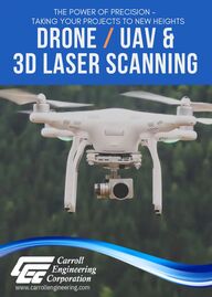
THE POWER OF PRECISION - TAKING YOUR PROJECTS TO NEW HEIGHTSdrone / uaV & 3d laser scanning www.carrollengineering.com
Carroll Engineering’s departments have been utilizing the drone’sability to capture aerial views of clients’ projects from start to finish,pre-planning initiatives, site mapping, and offer real-time videocaptures for hard-to-see areas using accuracy and speed. Our licenseddrone pilots use their experience to remotely navigate the unmannedaerial vehicle (UAV), as it collects aerial data through its pivotal imagerysensors. For instance, when used in a drone survey, a client can requestmeasurements at certain distances and in other specified volumetricdistances. Project managers can inherently benefit from utilizing thedrone information for day-to-day project updates and staying informedto make quicker reaction times to any project delays that can arise.
Topographic SurveysBoundary SurveysALTA/NSPS Land Title SurveysSite Progress SurveyRight-of-Way Acquisition PlansUtility SurveysSubdivision and Lot Consolidation PlansAs-Built SurveysUAV/Drone SurveyingAerial Photogrammetry
3D Mapping with Ground Control Points (GCPs)Site ReconnaissanceRoadway AssessmentCulvert/Bridge InspectionsStreambank/Steep Slope AccessPark and Open Space Aerial ImageryWater Tank/Standpipe InspectionBuilding/Roof InspectionTreatment PlantsOrthophotographyTerrain Modeling
Utility Substation As-Built SurveysRoadway Mapping Road IntersectionsOverhead Wire Clearances StructureMonitoring Bridge Locations andClearances Stormwater/WastewaterManagement BuildingFacades/Interiors ADA ComplianceSurveys
Bridge/Culvert Bridge Inspection North Whitehall TownshipLehigh County, PABuilding Exterior Survey Scan Carroll Engineering, being the surveyor ofrecord, was tasked to provide base mappingand design for proposed building additions,underground detention basins, storm structures,curb, walls, sidewalk, amongst other items. Thedesign was based upon the existing buildingfaçade, foundation, and finished floor. To ensureour client received the most accurateand timely product possible, CEC also performed laser scanning duties along theface of each building.As part of CEC performing engineeringservices for the Covered Bridge PreservationProject, CEC used the Drone/UAV to obtainvideo and photographs of the inside of thestructure, beneath the bridge, and inspect theslate roof. By using the drone, CEC was able toobtain valuable information concerning theexisting condition of the bridge members andobserve the existing roof in a safe and efficientmanner.Municipality of PrincetonMercer County, NJ
carrollengineering.com • 215-343-5700 • info@carrollengineering.comCarroll Engineering Corporation, founded in 1973, is one of theregion’s largest consulting engineering, planning, and surveyingfirms. The firm employs professionals and staff acrossSoutheastern Pennsylvania and Central New Jersey at offices inWarrington, Bucks County, Pennsylvania; Easton, NorthamptonCounty, Pennsylvania; King of Prussia, Montgomery County,Pennsylvania; Malvern, Chester County, Pennsylvania; andHillsborough, Somerset County, New Jersey. Contact us today to learn more about our high-qualityengineering and surveying services, and how we cansupport your next project.