Return to flip book view
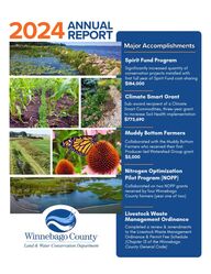
Message Spirit Fund ProgramSignificantly increased quantity ofconservation projects installed withfirst full year of Spirit Fund cost-sharing$184,000Climate Smart GrantSub-award recipient of a ClimateSmart Commodities, three-year grantto increase Soil Health implementation $775,690Muddy Bottom FarmersCollaborated with the Muddy BottomFarmers who received their firstProducer-led Watershed Group grant$5,000Nitrogen OptimizationPilot Program (NOPP)Collaborated on two NOPP grantsreceived by four WinnebagoCounty farmers (year one of two)Livestock WasteManagement OrdinanceCompleted a review & amendmentsto the Livestock Waste ManagementOrdinance & Permit Fee Schedule(Chapter 13 of the WinnebagoCounty General Code)ANNUALREPORT2024
LAND & WATERCONSERVATIONin WISCONSINIn Wisconsin, every county has aLand and Water Conservation Department (LWCD) and a LandConservation Committee (LCC) that are the"boots on the ground" implementers ofconservation in their local communities.LWCD staff are trusted advisors to privatelandowners and farmers, providingeducational, technical, and conservationplanning assistance to help communitiescontrol rural and urban soil erosion; protectlakes, streams and groundwater; managewoodlots, forests, and wildlife; and accessvital cost-share funding. In doing so, theyhelp landowners achieve their landmanagement objectives while meetingconservation standards at the same time.LCC members are community members,business owners, and farmers, most ofwhom are elected county board supervisors.They serve with the authority granted themvia Wisconsin Statutes (Chapter 92),Wisconsin's Soil and Water ConservationLaw. LCCs approve local conservationpriorities defined by LWCDs in Land andWater Resource Management plans.Federal, state, and local conservationprograms are implemented at the local levelby LWCDs. As such, their expertise is key toputting in place practices that improve ourland, and in so doing, protect our water.Source: LCC Handbook 2024-2026, WI Land +Water Conservation Association.Conservation on the Land • OUR COST-SHARE FUNDINGThe LWCD facilitated of cost-sharing to landowners andproducers for conservation practices INSTALLED in 2024.Structural Practice Funding: $275,111Soil Health Practice Funding: $215,918Including the cost contributed by landowners, this resulted in a total of in conservation practices installed to protect surfacewater and groundwater throughout Winnebago County in 2024. $491,028$533,585SWRM$86,086GLSNRP$53,990Landowner*$42,557Climate Smart$40,642MDV$12,600NFWF$7,597 Land & Water Conservation Department (LWCD) Winnebago County
SFP$183,824WQIP$106,2892024 Annual ReportWQIP (Water Quality Improvement Program)Funded by Winnebago County, this is the LWCD’s primary programfor providing cost-sharing to landowners. WQIP provides up to 70%cost-sharing on eligible conservation practices.SFP (Spirit Fund Program)Developed in 2023, the SFP utilizes $3,030,000 of ARPA fundingawarded to the LWCD to increase the quantity of conservationpractices installed in Winnebago County. This program isdesigned to provide additional funding for installation ofconservation practices over the next 10-15 years.Farm Climate SmartThis three year United States Department of Agriculture (USDA)grant is an eight county joint effort spearheaded by the FWWAthat provides cost-sharing to producers implementing cover cropsand no-till practices.SWRM (Soil and Water Resource Management)The Wisconsin Department of Agriculture, Trade and ConsumerProtection (DATCP) awards annual SWRM grants to co unties. Thesegrants assist in funding for LWCD conservation staff and cost-sharing for conservation practices installed throughout the county .MDV (Multi-Discharger Variance)By participating in the Wisconsin Department of NaturalResources (DNR) multi-discharger variance program forphosphorous, counties have access to financial resources fornonpoint source pollution control activities in specific watersheds.NFWF (National Fish & Wildlife Foundation)In partnership with FWWA, Winnebago County received a grantfrom NFWF to provide incentive funds for producers toimplement the soil health practices of cover crops and no-tillinto their farm operations. GLSNRP (Great Lakes Sediment & Nutrient Reduction Program)In partnership with Fox-Wolf Watershed Alliance (FWWA),Winnebago County received a grant through the GLSNRProgram to provide incentive funds for producers to implementthe soil health practices of cover crops, no-till, and low-disturbance manure applications into their farm operations. STATE FUNDINGCOUNTY FUNDING*LANDOWNER CONTRIBUTIONFEDERAL FUNDINGLandowners/producers also contribute financially to theconservation practices installed/implemented on their property.For structural practices the landowner’s contribution typicallyranges from 10-30% of the total cost of the practice installation(this $ amount is reflected in the pie chart). For soil health practices producers contribute their own farmresources (equipment, manpower, materials, etc) up front. Theyreceive incentive payments/acre for the conservation practicesthey implement which helps offset a percentage of their costs.
Land & Water Conservation Department (LWCD) Winnebago County2024 Annual ReportWinnebago County HUC 12 WatershedsWinnebago County HUC 12 WatershedsConservation on the Land • OUR PRACTICE LOCATIONSThe map below shows the location of conservation practices that were installed throughout Winnebago County in 2024.Areas of highest concern are identified through the Erosion Vulnerability Analysis for Agricultural Lands (EVAAL), reports ofconcerns from landowners, community members, and/or other agencies, and on-site surveys completed by LWCD staff.In combination with guidance and mandates from the Agriculture Performance Standards and the WI DNR’s Total MaximumDaily Load (TMDL) plan for pollution reduction, the LWCD conducts targeted outreach and practice installation in prioritywatersheds to maximize water quality benefits. In 2024, priority watersheds included the Town of Dale-Rat River, LakePoygan, and Lake Butte des Morts-Fox River Watersheds.
The Winnebago System is one of Wisconsin’s most significantwater resources, representing 17% of the State’s total surfacewater acreage. It is located within 75 miles of over 2 million people andreceives heavy recreational use for fishing, boating, swimming,hunting, and trapping. In addition, Lake Winnebago alone provides drinking water toover 200,000 people in the communities of Oshkosh, Neenah,Menasha, Appleton, Sherwood, and Waverly.Winnebago County has over 91,000 acres of surface water, which isthe largest area of inland surface water of any county in Wisconsin.Source: Winnebago County 2021-2030 Land & Water Resource Management PlanThe majority of Winnebago County’s main water bodies are on theWisconsin DNR’s list of 303(d) Impaired Waters. The Erosion Vulnerability Assessment for Agricultural Lands (EVAAL)helps LWCD staff identify potential locations for conservation practices. Wisconsin law requires each county to have a Land and Water ResourceManagement Plan (LWRMP) that has been approved by the WisconsinDepartment of Agriculture, Trade, and Consumer Protection (DATCP). Plans are approved for a 10-year period, with a review by the Land andWater Conservation Board in year five .Winnebago County’s 2021-2030 Plan includes information from EVAAL andother inventories and assessments that help identify specific resourceconcerns and geographic areas of focus, with the goal being maximumimprovement to water quality while taking into account the current level offinancial and staffing resources available in Winnebago County. EVAAL Model 2020The Clean Water Act of 1972 requires states to prepare a list of waterbodies that are impaired and will remain so even after point sources ofpollution (like industrial and municipal discharges) have installedrequired pollution controls. The majority of Winnebago County’s lakesand rivers are on the WDNR’s list of 303(d) Impaired Waters and willrequire additional action to be restored.Through the decades, high water levels combined with erosive actionfrom wind, waves, and ice shoves have led to the destruction of tens ofthousands of acres of wetland habitat along Winnebago Countyshorelines and streambanks resulting in a loss of natural filtration totrap sediment and nutrients from nonpoint sources such as urban andagricultural runoff.Excessive sediment and nutrient delivery into Winnebago County watersare the contributing factors for impaired status on the 303(d) list.
Land & Water Conservation Department (LWCD) Winnebago County2024 Annual ReportSediment and other pollutants contained in runoff from the urban and agricultural landscape, along with themismanagement of land resources, continue to have the most significant impact on the quality of soil and waterresources. Landowners installing structural practices commit to a 10-15 year operation & maintenance plan to keeppractices on the land for long-term pollutant reduction. Producers implementing soil health practices commit to a two-sixyear enrollment that assists with successful establishment of soil health practices as part of regular farm operations.STREAM BANK/SHORELINE PROTECTIONVegetation, rock, or both used to stabilize and protect the banks ofstreams, lakes, estuaries, or excavated channels against scour anderosion to reduce sediment delivery to a water body.Installed in 2024: 101 linear feetRIPARIAN BUFFERA riparian buffer includes plantingforbs and grasses adjacent towaterways and shorelines tostabilize banks, filter runoff, andenhance wildlife habitat.Installed in 2024: 12.3 acresSTREAM CROSSING A stabilized area or structure built across astream to allow controlled access for people,livestock, equipment, or vehicles, minimizingenvironmental damage. Installed in 2024: 62 linear feetAGRICULTURAL SEDIMENT BASINAlso known as a water and sediment control basin (WASCOB), this earth embankment with an excavated dugout is constructedacross minor drainageways with an engineered inlet/outlet to reduce gully erosion, trap sediment, and manage runoff in ag fields.Installed in 2024: 2 jobsWATERWAY SYSTEMA natural or constructed drainageway orchannel shaped, graded and vegetatedto prevent erosion by channelized flow.Installed in 2024: 4.9 acresWETLAND RESTORATIONRestoring wetlands through excavation,berm construction, and disabling fieldtile and drainage ditches to slow downand filter agricultural runoff.Installed in 2024: 1.2 acresConservation on the Land • ABOUT OUR PRACTICESSHORELINE HABITAT RESTORATION Shoreline habitat restoration (SHRUB) involves plantingnative vegetation along shorelines to stabilize the soil, filterrunoff, and create a natural buffer zone that improves waterquality & provides habitat for wildlife. Installed in 2024: 134 linear feet
COVER CROPA cover crop is grown outside of theregular cash crop season and is used toslow erosion, improve soil health, enhancewater availability, and smother weeds.Installed in 2024: 2,193 acresNUTRIENT MANAGEMENT Nutrient Management Plans (NMPs) involve managing the application offertilizers and other nutrients to crops.The goal is to maximize crop yields andminimize environmental impact byensuring plants receive the RIGHTnutrients at the RIGHT amount, at the RIGHT time, and in the RIGHT location.New Enrollments 2024: 1,247 acres RAIN GARDEN Rain gardens are shallow landscaped depressions planted withnative wildflowers & grasses that soak up rain water drainingfrom the roof of a house or other building. This reduces andfilters water runoff before it enters a storm drain.Installed in 2024: 5 jobsWASTE STORAGE FACILITY CLOSUREThe decommissioning of a facility where agricultural wastehas been treated or stored that is no longer being used. Properclosure protects the quality of surface water and groundwater,mitigates air emissions, eliminates safety hazards, andsafeguards public health.Closures in 2024: 3 jobs BARNYARD RUNOFF CONTROLThe use of structural measures to divert clean water fromlivestock areas and prevent manure runoff on livestock lotsfrom reaching surface water and groundwater. Installed in 2024: 1 job WELL DECOMMISSIONINGWell decommissioning (abandonment), involvesthe permanent closure and sealing of a well toprevent contamination.2024 Wells Decommissioned: 8 jobsNO-TILL No-till leaves the soil undisturbedbetween harvest and planting seasonsto maximize retention of crop andplant residues. Installed in 2024: 956 acresSOIL HEALTH CHALLENGE (SHC)The Soil Health Challenge is a six year program that provides incentivepayments to producers who implement soil health practices as part oftheir farming operation (maximum of 20 acres). Producers also providedemonstrations and educational events such as field days.Participating in 2024: 94 acres
t Land & Water Conservation Department (LWCD) Winnebago County2024 Annual ReportTown of Dale-Rat RiverRush CreekLake Butte des MortesSpring BrookHogars BayouLake PoyganDaggetts CreekPumpkinseed CreekAlder CreekVan Dyne CreekWillow HarborEightmile CreekLake WinnebagoArrowhead RiverCity of OshkoshCity of BerlinLittle Lake Butte des MortsPine River05010015020025030024610596846743363115 15132124 41 02024 SEDIMENT Reductions by WatershedSEDIMENTPHOSPHOROUS2024763 tons3,657 lbs2023385 tons1,258 lbsConservation on the Land • OUR IMPACTThe impact of conservation practices are measured by reductions in the amount of sediment and phosphorous runoffinto surface waters. Since actual reductions are measured long-term, models have been developed to estimate annualpollutant reductions based on type/size of practice location, soil type, land use, etc. These models are used by the WDNRand DATCP to determine progress towards Total Maximum Daily Load (TMDL) goals. Winnebago County Annual Pollutant ReductionsIncreased reductions in 2024 reflect additional practices installeddue to an increase in cost-share funding available through theCounty Spirit Fund Program & FWWA Climate Smart Grant.About SedimentSediment pollution, primarily caused by erosion, is amajor water quality problem, impacting both naturalecosystems and human activities. It occurs when loosesand, silt, clay, and other materials are washed or carriedinto water bodies. This pollution can cause cloudy water,harm aquatic life, reduce water quality, and increasetreatment costs. In agricultural watersheds, the most significant sourceof sediment comes from tilled fields. Farm fields,especially when conventional tillage is used, lackcontinuous vegetation and plant residue to hold the soil inplace, resulting in increased sediment runoff.
Town of Dale-Rat RiverLake Butte des MortesLake PoyganRush CreekHogars BayouPumpkinseed CreekAlder CreekSpring BrookArrowhead RiverWillow HarborDaggetts CreekEightmile CreekVan Dyne CreekCity of BerlinPine RiverLake WinnebagoCity of OshkoshLittle Lake Butte des Morts020040060080084680448530229628114812510383724823362102024 PHOSPHOROUS Reductions by WatershedRunoff from both urban and rural areas containsnutrients such as phosphorous and nitrogen.Phosphorous, often carried in with the sediment, fuelsthe growth of algae and aquatic weeds. Rapid andexcessive growth of algae and aquatic plants candegrade water quality and interfere with swimming,fishing, and other recreation.When algae die, they sink to the bottom and decomposein a process that removes oxygen from the water. Fishand other aquatic organisms die when dissolved oxygenlevels are lowered.Phosphorous compounds attach to the soil particles insediment, but phosphorous can also be in a soluble form.Urban sources of phosphorous include lawn fertilizers,pollen, leaves, grass and orthophosphate in vehicleexhaust. One pound of phosphorous can produce300-500 pounds of algae.Nonpoint source pollution, also known as polluted runoff, is a leading cause of waterquality problems in Wisconsin. Polluted runoff is caused by rainfall or snowmelt movingover and through the ground picking up natural and human–made pollutants, depositingthem into rivers, lakes, wetlands, and groundwater. Pollutants include fertilizers, nutrients,oil, grease, sediment, and bacteria from agricultural, urban, and residential areas.https://dnr.wisconsin.gov/topic/Stormwater/learn_more/problems.htmlAbout Phosphorous20
Land & Water Conservation Department (LWCD) Winnebago County2024 Annual ReportABOVE: Field “stripes” show where different rates of Nitrogen were applied. RIGHT: Ears of corn grew at different rates under different Nitrogen applications.Data gathered over time can assist with farm decision making. Winnebago County has been a partner in the UFW DFN since 2020. This collaborationincludes nine LWCDs, the Green Lake Association, and the Natural Resource ConservationService (NRCS) in the Upper Fox River and Wolf River Watersheds. UFW DFN is funded by theGreat Lakes Restoration Initiative. The Demonstration Farms represent a wide range of farmtypes working together to test and demonstrate conservation practices to reduce nonpointsource pollution entering the Great Lakes Basin. The conservation knowledge learned on theirfarms is shared by hosting educational field days to help other farmers implement soil healthpractices. Currently, the UFW DFN is comprised of 14 farms, with three located inWinnebago County. For more information visit the UFW DFN on Facebook.The LWCD is the collaborator for the Muddy Bottom Farmers (MBF) Producer-Led WatershedGroup who received their first DATCP (Department of Agriculture, Trade & Consumer Protection)grant in 2024 to continue their growth. A Producer-Led Group is led by farmers, for farmers tocollaborate on programs and host events to share conservation knowledge. The MBF started in2023 with five main farmers. In 2024, the MBF hosted a Winter Workshop, an August Field Day,participated in many other soil health events, and expanded their network to 30 farmers. For more information visit the MBF on Facebook and view the 2024 MBF Annual Report. Conservation Services • FOCUS ON SOIL HEALTHThe LWCD assists with the following initiatives designed to promote soil health practices throughout Winnebago Countywatersheds. These initiatives provide expertise to producers who are new to soil health, and challenge experiencedproducers to expand their knowledge and share what they’ve learned with other producers, professionals and the public.UPPER FOX-WOLF DEMONSTRATION FARMS NETWORK (UFW DFN)PRODUCER-LED WATERSHED GROUPThe LWCD is the collaborator for a two-year NOPP grant received from DATCP. NOPP grantsprovide funding to farmers for conducting field research on different application rates ofcommercial nitrogen fertilizer. Farmers compare different applications to find the optimal rateof return while avoiding runoff concerns. Each field is a stand alone research study that uses astatistical approach to differentiate the results. In 2024 the LWCD collaborated on NOPPgrants with three farms in the MBF and one farm in the UFW DFN. For more information viewthe 2024 NOPP Annual Report. NITROGEN OPTIMIZATION PILOT PROGRAM (NOPP)
2024 FARM CLIMATE SMART ACRES BY WATERSHEDFARM CLIMATE SMART GRANTIncorporating no-till planting practices as well as utilizing cover crops has beenshown to significantly reduce runoff of both sediment and phosphorus to improvewater quality. Producers must maintain both no-till planting and cover crops for theduration of a two-year contract. Producers receive one-on-one mentorship andguidance as they implement soil health practices. The goal of mentorship is to increasesuccess rates and encourage the long-term adoption of these practices as a part ofongoing farm operations. Outreach in Winnebago County began in April 2024. 15 producers located throughout ten of the watersheds inWinnebago County signed contracts in 2024 totaling 1,951 acres. Ten of these producers have already begun meetingthe deliverables of the grant by seeding cover crops after the harvest of their commodity crop in fall of 2024. The impacton water quality is tracked by watershed using modeling to calculate annual sediment and phosphorous reductions.In 2024 Winnebago County was one of eight counties in the Fox-Wolf Watershedawarded 2,000 acres of cost-sharing to incentivize and support producers toimplement soil health practices through a USDA Farm Climate Smart Grant. In partnership with the USDA and FWWA, this grant encourages sustainable farmpractices by providing incentives, and more importantly, one-on-one technicalassistance to producers. The three-year grant included hiring a new full-time GrantSoil Health Specialist. A certified agronomist was hired for this position at theWinnebago County LWCD in February of 2024.No-till & cover crops (Fall 2024). Year 1 Field: Climate Smart Grant.Winter rye and radish mix.Cover crop (Fall 2024). Cover crop verification. Plants arecounted by the sq. ft. to determinesuccess of seeding.
Land & Water Conservation Department (LWCD) Winnebago County2024 Annual ReportConservation Services • COLLABORATIONIn addition to helping landowners and producers to install conservation practices, the LWCD collaborates with othercounty departments, community, state, and federal agencies to administer conservation programs and assist with thecompliance of local ordinances and state statutes. TECHNOLOGY & GIS SERVICESFARMLAND PRESERVATION - TOWN OF NEPEUSKUNLIVESTOCK WASTE MANAGEMENT ORDINANCE (LWMO) What does a LWMO do?Regulates and permits manure storage and transfersystem locations; verifies construction forenvironmental safetyPermits livestock facilities and livestock lots tomaintain a safe distance from surface water andwetlands to prevent runoff pollutionRegulates and permits the abandonment/closure ofwaste storage facilities; verifies environmental safetyRegulates the distance from livestock waste to wells to protect groundwaterFollows the Agriculture Performance Standards (NR151)Livestock Waste Prohibitions Follows the Manure Spreading rules for livestock wastedetailed in WI NRCS Code 590 to protect water qualityIn 2024, the LWCD and LCC completed a thorough review of the ordinance which resulted in the LWMO beingamended to update referenced State Statutes, technical standards, definitions, and the current Permit Fee Schedule.14 LWMO Permits were issued in 2024.The Livestock Waste Management Ordinance (LWMO) has been part of the Winnebago County General Code since 1985.The goals of the LWMO are to prevent water pollution and the spread of disease to protect the health and safety of residents.NUTRIENT MANAGEMENT PLAN (NMP)A NMP is a requirement of Wisconsin State Statute NR 151 for any farm utilizingcommercial fertilizer or manure. The LWCD receives cost-share funds throughDATCP for approximately 1,200 acres per year to incentivize farmers completinga NMP for the first time. LWCD staff provide one-on-one training on creating andutilizing a NMP and track ongoing compliance with NR 151. Farmers mustcontinue to submit a NMP to the LWCD annually.In 2024 57% of Winnebago County farms have a NMP totaling 61,250 acres. The Wisconsin Farmland Preservation Program (FPP) provides an income tax credit to Wisconsin farmers in exchange forkeeping land in agricultural use and maintaining compliance with the State Agricultural Performance Standards (NR 151). In 2024 Winnebago County had 38 participants in the Town of Nepeuskun totalling 4,168 acres.The LWCD is one of the heavier users of technology among the County Departments. GIS (GeographicInformation Systems), AutoCAD (Computer Aided Design Software) and GPS (Global PositioningSystem) are core software and hardware tools that are used daily. GIS is used for creating base mapsof sites to sophisticated predictive models, such as EVAAL (Erosion Vulnerability Assessment forAgricultural Lands), that help to plan best management practices (BMP) locations. AutoCAD and GPSare used by Conservation Technicians to design the BMP projects for installation on the landscape.GIS is also used for the LWCD BMP Tracker, which allows the department to track where BMPs havebeen installed and the sediment and phosphorus reductions achieved.
LWCD staff provided a variety of information and educational opportunities to landowners, producers, students of allages, and the general public. The goal of these outreach efforts is to educate about conservation concerns inWinnebago County and to promote conservation practices that will help mitigate these concerns. 2024 I&E Activities Included:Annual Conservation Poster Contest (16 entries/5 age categories)Winneconne Community School District: Conservation Field Day (4th grade) & Career Day (8th grade)Fox Valley Technical College: Tech Tours & Class PresentationsField Days (through UFW DFN, NOPP, MBF, SHC, etc.)Community presentations: UWO Learning in Retirement, OASD E-Academy, OASD Youth Governance Days, etc.Marketing booths & displays (Oshkosh Chamber of Commerce Business Expo, WPS Farm Show, Winnebago County Fair)Developed educational signage for a stormwater runoff demo project (Prairie Treatment System located at JP Coughlin Center)Developed educational signage to identify conservation installedMonthly outreach provided on FacebookParticipation on steering teams, work groups, and leadership boards, such as Winnebago Waterways, FWWA, Lake Winnebago Land & Water Conservation Association, and WI Land+Water AssociationWILDLIFE DAMAGE ABATEMENT & CLAIMS PROGRAMTREE PLANTING SUPPLIES & EQUIPMENTCONSERVATION RESERVE ENHANCEMENT PROGRAMCREP is a partnership between DATCP, USDA FSA, USDA NRCS, andparticipating County LWCDs. CREP offers Wisconsin landowners anopportunity to receive financial incentives to voluntarily stop farming landabutting streams and wetlands and enroll them into conservation practices,such as riparian buffers, filter strips, wetlands, and native grasslands. The program’s goal is to reduce runoff pollution along Wisconsin’s streams andwetlands. In 2024, three Winnebago County landowners re-enrolled atotal of 22 acres into 15-year buffer agreements. Winnebago Countycurrently has 741 acres enrolled in 15-year agreements and 81 acresenrolled in perpetual easements.WDACP is a statewide program that issues permits to landowners experiencing cropdamage caused by deer, geese, and turkeys to provide damage prevention assistanceand partial compensation to farmers for damage to crops. The LWCD and LCC assistwith the local administration of the WDACP, in partnership with USDA APHIS and WDNR. In 2024 four landowners participated in WDACP and received a total of $11,833 inreimbursements for wildlife damage.The LWCD partners with the WDNR Tree Planting Program to assist with the distribution oftrees/shrubs purchased through the annual WDNR sale. Landowners primarily use thetrees/shrubs for riparian buffers, wildlife enhancement areas, or timber production. As partof the tree distribution day, the LWCD provides tree planting equipment rentals and sellstree planting supplies such as fertilizer tablets and moisturizing root gel. In 2024 a record number of 150,600 seedlings were distributed through the DNR tree saledue to multiple large reforestation projects in the county. The LWCD had 10 tree plantingequipment rentals and sold 292 bags of root gel, 1,675 fertilizer tablets, 274 tree shelters,and 8 tree planting bars.INFORMATION & EDUCATION (I&E)CREP BufferExample
Land & Water Conservation Department (LWCD) Winnebago County2024 Annual ReportEric Bertram joined the LWCD team as the Grant SoilHealth Specialist in February of 2024. Eric was born andraised about 10 minutes north of Fond du Lac on the eastside of Lake Winnebago. He is a graduate of UW StevensPoint. For the last 15 years, Eric worked in the private sectoras an Agronomist and obtained his CCA (Certified CropAdvisor) certificate in 2015. In his free time, Eric enjoys thesport of curling and is the President of the Appleton CurlingClub. His other hobbies include projects around the houseand yard, woodworking, traveling, gardening, and helping onhis hometown farm with field operations & harvest. Isaac Whiting joined the LWCD team as the WatershedSpecialist in October of 2024. Isaac was born and raised inWinnebago county where he farms with his family. He earneda degree in environmental science from the University ofMinnesota, focusing on water resources. He has a passion foragriculture and is active in the industry in both his privateand professional life. In his free time Isaac enjoys running,cooking, and bonfires.Adam Sattler joined the LWCD team as the GIS Specialistin July of 2024. He has lived in Oshkosh since graduatingfrom UWO with a degree in Environmental Studies. He iscurrently focused on updating our Best ManagementPractice map and database, running EVAAL and ACPFerosion modeling for each watershed in the county, andlearning the regulations and techniques of flying a drone.When Adam is not making maps he enjoys hiking andcamping with his family or working to transform their 1 acrelot into an urban farm, food forest, and native habitat.Chad CasperDirectorAdam SattlerGIS SpecialistMelanie LeetResource ConservationistAlix Bjorklund-PatilConservation TechnicianBrandon FlenzConservation TechnicianIsaac WhitingWatershed SpecialistEric BertramSoil Health SpecialistSheila SmithAgronomistThe Wisconsin model of conservation with LWCDs and LCCs in every county prides itself on local conservationprofessionals who are the “boots on the ground” that work directly with landowners and producers.The Land & Water Conservation Department (LWCD) has a staff of nine County employees withbackgrounds in soil and water conservation, environmental science, resource management, agronomy,watershed management, geography, natural resources, graphic design, communications, and geographic informationsystems. In Wisconsin, locally-led conservation is key to healthy soils, resilient farms, clean water, and vibrantcommunities. LWCD staff are trusted advisors to private landowners and farmers.The LWCD works closely with the Winnebago County Board Land Conservation Committee (LCC), other WinnebagoCounty Departments, and local, state, and federal agencies to implement the County's Land & Water ResourceManagement Plan.Boots on the Ground • OUR STAFF & COMMITTEEJody BezioAdministrative AssociateLand & Water Conservation DepartmentTHANK YOU to Emily Dufeck and Andy Maracini (former LWCD staff ) for your contributions to county conservation in 2024.
Welcome to Supervisors Kristl Laux and Tim Macho whojoined the Land Conservation Committee in May of 2024. Kristl is the District 2 Supervisor in Menasha Tim is the District 20 Supervisor in Oshkosh Land Conservation CommitteeKristl LauxCounty Board MemberLCC SecretaryTim MachoCounty Board MemberDaniel StokesCitizen MemberBruce BohnCitizen MemberChuck FarreyCounty Board MemberLCC ChairDouglas NelsonCounty Board MemberLCC Vice ChairDoug ZellmerCounty Board MemberWinnebago County Board Chapter 92 of the Wisconsin State Statutes requires counties to have an LCC that oversees the administrationand implementation of conservation programs that meet local priorities and the needs of land users. Theseprograms might be local or they can be state programs implemented at the local level. Committee membershipincludes citizens who represent the local agricultural community and County Board Supervisors. WinnebagoCounty LCC meetings are held on the 1st Monday of the month and are open to the public.Agendas, minutes and recordings for all County Board and committee meetings can be found on the CountyBoard calendar: https://winnebagocowi.portal.civicclerk.com/ County Board committee information: https://www.co.winnebago.wi.us/county-board/committeesCounty Board website: https://www.co.winnebago.wi.us/county-boardLand Conservation CommitteeTHANK YOU to Kay Horan and Julie Gordon (former CountyBoard Supervisors) who completed their terms on the CountyBoard and the Land Conservation Committee in April of 2024.
625 E. Cty Rd Y, Oshkosh, WI 54901www.co.winnebago.wi.us/lwcd(920) 232-1950 or (920) 727-8642WinnebagoLWCDGrades 7-9Maeli Habersetzer, Grade 9Winneconne High SchoolGrades 10-12Ava Hoger, Grade 11St. Mary Catholic High, NeenahGrades K-1Clara Rehberg, Grade 1Winneconne Elementary SchoolGrades 2-3Will Stewart, Grade 2Winneconne Elementary School Grades 4-6Ella Stewart, Grade 6Winneconne Middle Schoolhttps://www.co.winnebago.wi.us/lwcd/information-and-education/poster-contestThe Winnebago County Land and WaterConservation Department (LWCD) is dedicatedto providing a full range of professionalservices in the planning, design, andimplementation of programs and projects thatPROTECT, RESTORE, AND SUSTAINthe NATURAL RESOURCES of Winnebago CountyMISSION